 Old Cumbria Gazetteer
 |
 |
|
| milestone, Staveley-in-Cartmel (2) | ||
| site name:- | road, Kendal to Ulverston | |
| site name:- | road, Lancaster to Ulverston | |
| civil parish:- | Staveley-in-Cartmel (formerly Lancashire) | |
| county:- | Cumbria | |
| locality type:- | milestone | |
| coordinates:- | SD38278507 | |
| 1Km square:- | SD3885 | |
| 10Km square:- | SD38 | |
|
|
||
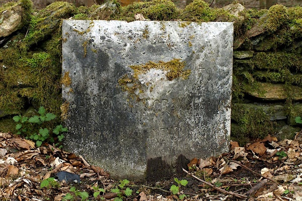 BPC50.jpg Inscribed stone:- "TO ULVERSTON 10 ML BARROW 18 [3]/4 , / STAVELEY / TO GRANGE 5¾MLS KENDAL 165 , LANCASTER 27 ," (taken 26.4.2008) |
||
|
|
||
| evidence:- | old map:- OS County Series (Lan 12) |
|
| source data:- | Maps, County Series maps of Great Britain, scales 6 and 25
inches to 1 mile, published by the Ordnance Survey, Southampton,
Hampshire, from about 1863 to 1948. "M.S. ULVERSTON 9 MILNTHORPE 13" |
|
|
|
||
 Lakes Guides menu.