 Old Cumbria Gazetteer
 |
 |
|
| Randlehow, Eskdale Green | ||
| Randlehow | ||
| Randle How | ||
| locality:- | Eskdale Green | |
| civil parish:- | Eskdale (formerly Cumberland) | |
| county:- | Cumbria | |
| locality type:- | buildings | |
| coordinates:- | SD14329988 | |
| 1Km square:- | SD1499 | |
| 10Km square:- | SD19 | |
|
|
||
| evidence:- | old map:- Donald 1774 (Cmd) placename:- Randale Holm |
|
| source data:- | Map, hand coloured engraving, 3x2 sheets, The County of Cumberland, scale about 1
inch to 1 mile, by Thomas Donald, engraved and published by Joseph Hodskinson, 29
Arundel Street, Strand, London, 1774.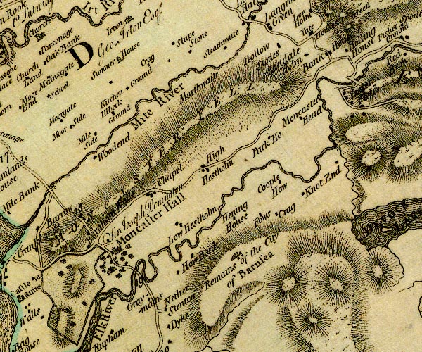 D4SD19NW.jpg "Randale Holm" block or blocks, labelled in lowercase; a hamlet or just a house item:- Carlisle Library : Map 2 Image © Carlisle Library |
|
|
|
||
| hearsay:- |
There is a date stone:- |
|
| "JN:1679" |
||
| decorated with a hammer, horseshoe and tongs. John Nicholson was the village blacksmith
here in the 17th century. |
||
|
|
||
 Lakes Guides menu.