Old Cumbria Gazetteer
 |
 |
|
||
| Chapel Beck (3) | ||||
| runs into:- |  Underbarrow Beck Underbarrow Beck |
|||
|
|
||||
| Chapel Beck | ||||
| civil parish:- | Underbarrow and Bradleyfield (formerly Westmorland) | |||
| county:- | Cumbria | |||
| locality type:- | river | |||
| 1Km square:- | SD4693 (etc) | |||
| 10Km square:- | SD49 | |||
|
|
||||
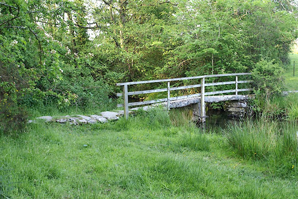
 BQQ34.jpg At the footbridge, (taken 29.5.2009) |
||||
|
|
||||
| evidence:- | old map:- OS County Series (Wmd 38 2) placename:- Chapel Beck |
|||
| source data:- | Maps, County Series maps of Great Britain, scales 6 and 25
inches to 1 mile, published by the Ordnance Survey, Southampton,
Hampshire, from about 1863 to 1948. OS County Series (Wmd 38 6) |
|||
|
|
||||
| evidence:- | old map:- Jefferys 1770 (Wmd) |
|||
| source data:- | Map, 4 sheets, The County of Westmoreland, scale 1 inch to 1
mile, surveyed 1768, and engraved and published by Thomas
Jefferys, London, 1770.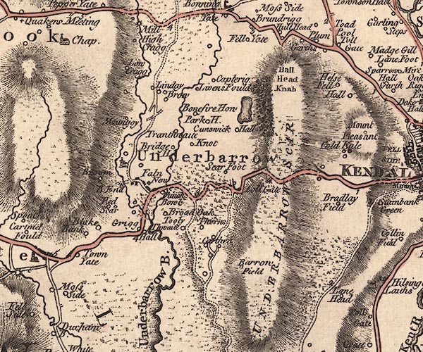 J5SD49SE.jpg single or double wiggly line; river item:- National Library of Scotland : EME.s.47 Image © National Library of Scotland |
|||
|
|
||||
| evidence:- | perhaps old map:- Cooper 1808 |
|||
| source data:- | Map, hand coloured engraving, Westmoreland ie Westmorland, scale
about 9 miles to 1 inch, by H Cooper, 1808, published by R
Phillips, Bridge Street, Blackfriars, London, 1808. click to enlarge click to enlargeCOP4.jpg tapering wiggly line; river, by Underbarrow and by Crook, confused item:- Dove Cottage : 2007.38.53 Image © see bottom of page |
|||
|
|
||||
| places:- |
|
|||
|
||||
|
||||
|
||||
Lakes Guides menu.