Old Cumbria Gazetteer
 |
 |
|
||
| Glassonby Beck | ||||
| runs into:- |  Eden, River Eden, River |
|||
|
|
||||
| locality:- | Daleraven | |||
| civil parish:- | Glassonby (formerly Cumberland) | |||
| civil parish:- | Kirkoswald (formerly Cumberland) | |||
| county:- | Cumbria | |||
| locality type:- | river | |||
| 1Km square:- | NY5639 (etc) | |||
| 10Km square:- | NY53 | |||
|
|
||||
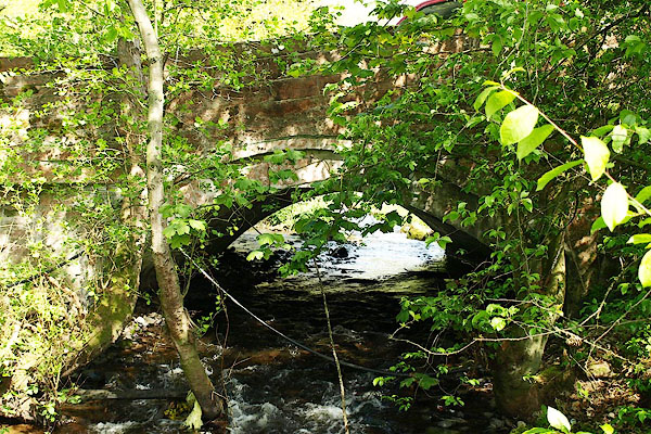
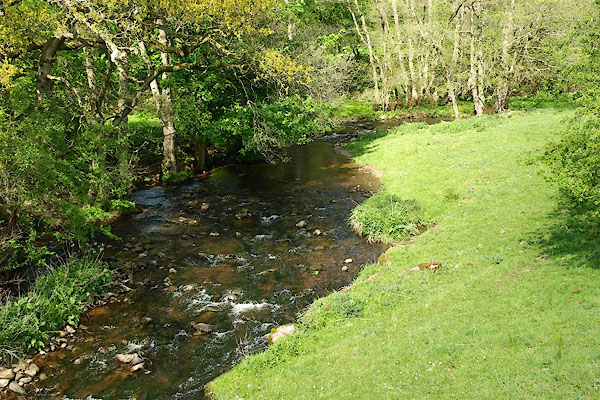 BQN11.jpg At Daleraven Bridge, (taken 8.5.2009) |
||||
|
|
||||
| evidence:- | old map:- OS County Series (Cmd 40 11) placename:- Glassonby Beck |
|||
| source data:- | Maps, County Series maps of Great Britain, scales 6 and 25
inches to 1 mile, published by the Ordnance Survey, Southampton,
Hampshire, from about 1863 to 1948. |
|||
|
|
||||
| evidence:- | old map:- Donald 1774 (Cmd) |
|||
| source data:- | Map, hand coloured engraving, 3x2 sheets, The County of Cumberland, scale about 1
inch to 1 mile, by Thomas Donald, engraved and published by Joseph Hodskinson, 29
Arundel Street, Strand, London, 1774.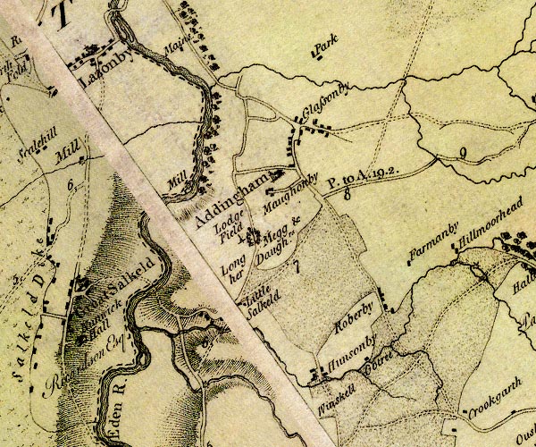 D4NY53NE.jpg single or double wiggly line; a river into the Eden N of Glassonby item:- Carlisle Library : Map 2 Image © Carlisle Library |
|||
|
|
||||
| evidence:- | old print:- Bogg 1898 |
|||
| source data:- | Print, The Del Raffen, Cumberland, by Owen Bowen, 1897, published by Edmund Bogg,
3 Woodhouse Lane, and James Miles, Guildford Street, Leeds, Yorkshire, 1898.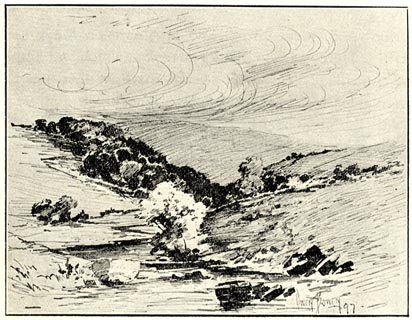 click to enlarge click to enlargeBGG119.jpg Included on p.64 of Lakeland and Ribblesdale, by Edmund Bogg; probably the Glassonby Beck through Daleraven. item:- JandMN : 231.19 Image © see bottom of page |
|||
|
|
||||
| places:- |
|
|||
|
||||
|
||||
Lakes Guides menu.