 Old Cumbria Gazetteer
 |
 |
|
| High Stockgill Bridge, Ambleside | ||
| High Stockgill Bridge | ||
| site name:- | Stock Ghyll | |
| Street:- | North Road | |
| locality:- | Ambleside | |
| civil parish:- | Lakes (formerly Westmorland) | |
| county:- | Cumbria | |
| locality type:- | bridge | |
| coordinates:- | NY37670457 | |
| 1Km square:- | NY3704 | |
| 10Km square:- | NY30 | |
|
|
||
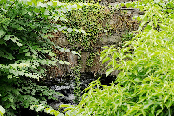 BQV90.jpg (taken 20.6.2009) |
||
|
|
||
| evidence:- | old map:- OS County Series (Wmd 26 6) placename:- High Stockgill Bridge placename:- Stockgill Bridge, High |
|
| source data:- | Maps, County Series maps of Great Britain, scales 6 and 25
inches to 1 mile, published by the Ordnance Survey, Southampton,
Hampshire, from about 1863 to 1948. |
|
|
|
||
| evidence:- | old print:- Green 1821 placename:- Stock Bridge |
|
| source data:- | Print, soft ground etching, Stock Bridge, Ambleside, by William Green, published at
Ambleside, Westmorland, 1821.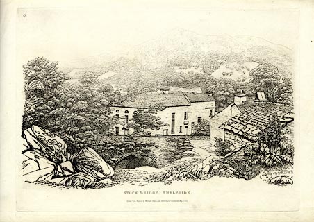 click to enlarge click to enlargeGN0217.jpg Plate 17 in Thirty Six Etchings from Nature. printed at upper left:- "17" printed at bottom:- "STOCK BRIDGE, AMBLESIDE. / Etched from Nature by William Green, and Published at Ambleside, May 1, 1821." item:- Armitt Library : A6638.17 Image © see bottom of page |
|
|
|
||
 Lakes Guides menu.