 Old Cumbria Gazetteer
 |
 |
|
| Swarthgill House, Garsdale | ||
| Swarthgill House | ||
| locality:- | Garsdale valley | |
| civil parish:- | Garsdale (formerly Yorkshire) | |
| county:- | Cumbria | |
| locality type:- | buildings | |
| coordinates:- | SD72669019 | |
| 1Km square:- | SD7290 | |
| 10Km square:- | SD79 | |
|
|
||
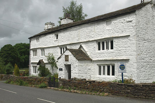 BQU99.jpg (taken 18.6.2009) 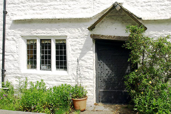 BQV02.jpg (taken 18.6.2009) |
||
|
|
||
| evidence:- | old map:- OS County Series (Yrk 64 6) placename:- Swarth Gill |
|
| source data:- | Maps, County Series maps of Great Britain, scales 6 and 25
inches to 1 mile, published by the Ordnance Survey, Southampton,
Hampshire, from about 1863 to 1948. |
|
|
|
||
| evidence:- | database:- Listed Buildings 2010 placename:- Swarth Gill item:- spice cupboard; date stone (1712) |
|
| source data:- | courtesy of English Heritage "SWARTH GILL / / HAWES ROAD / GARSDALE / SOUTH LAKELAND / CUMBRIA / II / 484483 / SD7266490190" |
|
|
|
||
| evidence:- | database:- Listed Buildings 2010 |
|
| source data:- | courtesy of English Heritage "BARN 30 METRES NORTH EAST OF SWARTH GILL HOUSE / / HAWES ROAD / GARSDALE / SOUTH LAKELAND / CUMBRIA / II / 484484 / SD7269490237" |
|
|
|
||
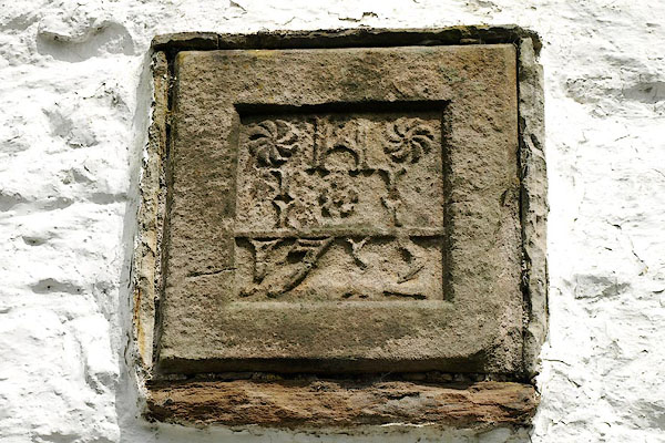 BQV01.jpg Date stone, dating the porch:- "H / I I / 1712" (taken 18.6.2009) |
||
|
|
||
 Lakes Guides menu.