 Old Cumbria Gazetteer
 |
 |
|
| Bannisdale Low Bridge, Fawcett Forest | ||
| Bannisdale Low Bridge | ||
| site name:- | Bannisdale Beck | |
| civil parish:- | Fawcett Forest (formerly Westmorland) | |
| civil parish:- | Whitwell and Selside (formerly Westmorland) | |
| county:- | Cumbria | |
| locality type:- | bridge | |
| coordinates:- | NY54270111 | |
| 1Km square:- | NY5401 | |
| 10Km square:- | NY50 | |
|
|
||
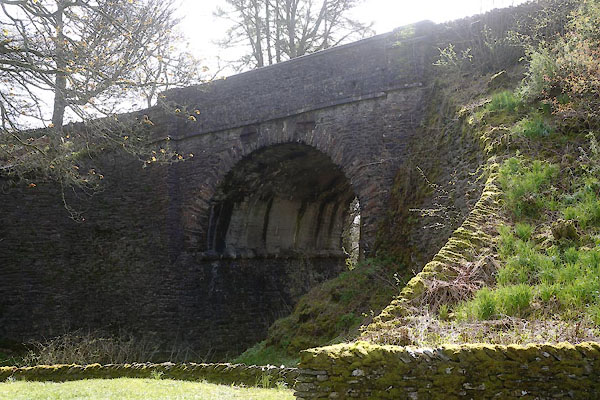 CCY24.jpg (taken 1.5.2015) |
||
|
|
||
| evidence:- | old map:- OS County Series (Wmd 34 1) placename:- Bannisdale New Bridge |
|
| source data:- | Maps, County Series maps of Great Britain, scales 6 and 25
inches to 1 mile, published by the Ordnance Survey, Southampton,
Hampshire, from about 1863 to 1948. "Bannisdale New Bridge" |
|
|
|
||
| evidence:- | database:- Listed Buildings 2010 placename:- Bannisdale Low Bridge |
|
| source data:- | courtesy of English Heritage "BANNISDALE LOW BRIDGE / / A6 / FAWCETT FOREST / SOUTH LAKELAND / CUMBRIA / II / 75627 / NY5426301112" |
|
| source data:- | courtesy of English Heritage "Bridge over Bannisdale Beck. 1820s. Stone rubble with dressed coping. Round arch with flanking piers, band over and coped parapet. Abutments on west side curve forwards. Roadway approx. 9m wide. On route of Heron Syke to Eamont bridge turnpike road established in 1820s, replacing old route over Bannisdale High Bridge (q.v.)." |
|
|
|
||
 Lakes Guides menu.