 Old Cumbria Gazetteer
 |
 |
|
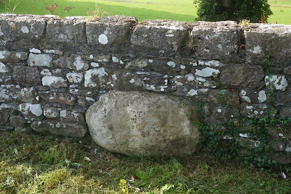
| Egg Pudding Stone, Broughton East | ||
| Egg Pudding Stone | ||
| locality:- | Four Lane Ends | |
| civil parish:- | Broughton East (formerly Lancashire) | |
| county:- | Cumbria | |
| locality type:- | stone | |
| coordinates:- | SD39438115 | |
| 1Km square:- | SD3981 | |
| 10Km square:- | SD38 | |
|
|
||
 CDW77.jpg (taken 11.9.2015) 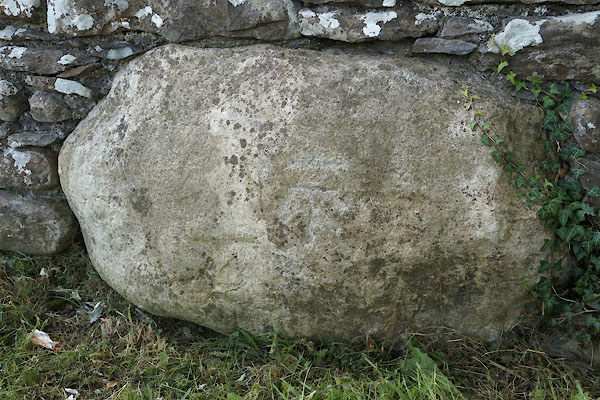 CDW78.jpg (taken 11.9.2015) |
||
| It goes right through the wall. |
||
| I'm sure a competition to invent stories for its name would generate some wonderful
ideas. |
||
|
|
||
| evidence:- | old map:- OS County Series (Lan 12 12) placename:- Egg Pudding Stone |
|
| source data:- | Maps, County Series maps of Great Britain, scales 6 and 25
inches to 1 mile, published by the Ordnance Survey, Southampton,
Hampshire, from about 1863 to 1948. |
|
|
|
||
 Lakes Guides menu.