 Old Cumbria Gazetteer
 |
 |
|
| Hellpool Bridge, Whicham | ||
| Hellpool Bridge | ||
| site name:- | Whicham Beck | |
| civil parish:- | Whicham (formerly Cumberland) | |
| county:- | Cumbria | |
| locality type:- | bridge | |
| coordinates:- | SD13868164 | |
| 1Km square:- | SD1381 | |
| 10Km square:- | SD18 | |
| references:- | OS County Series |
|
|
|
||
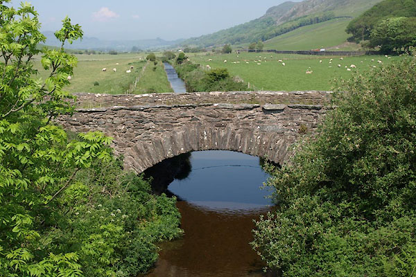 BWP47.jpg The old bridge. (taken 28.5.2012) |
||
| The present bridge for a rebuilt road is uninteresting. |
||
|
|
||
| evidence:- | old map:- OS County Series (Cmd 88 13) placename:- Hellpool Bridge |
|
| source data:- | Maps, County Series maps of Great Britain, scales 6 and 25
inches to 1 mile, published by the Ordnance Survey, Southampton,
Hampshire, from about 1863 to 1948. "Hellpool Bridge" |
|
|
|
||
| evidence:- | old map:- Bell 1892 placename:- Hell Pool Bridge |
|
| source data:- | Map, colour lithograph, Road Map of Cumberland, by George Joseph
Bell, scale about 2.5 miles to 1 inch, printed by Charles
Thurnam and Sons, Carlisle, Cumberland, 1892.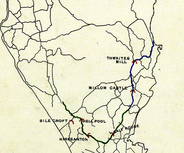 BEL9SD18.jpg "HELL POOL" bridge symbol Road map of Cumberland showing County Bridges item:- Carlisle Library : Map 38 Image © Carlisle Library |
|
|
|
||
 Lakes Guides menu.