 Old Cumbria Gazetteer
 |
 |
|
| High Liza Bridge, Brackenthwaite | ||
| High Liza Bridge | ||
| site name:- | Liza Beck | |
| locality:- | Brackenthwaite | |
| civil parish:- | Buttermere (formerly Cumberland) | |
| county:- | Cumbria | |
| locality type:- | bridge | |
| coordinates:- | NY15592234 | |
| 1Km square:- | NY1522 | |
| 10Km square:- | NY12 | |
|
|
||
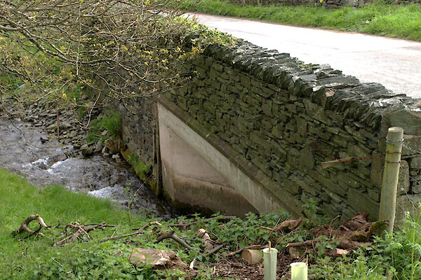 BWK87.jpg (taken 16.5.2012) 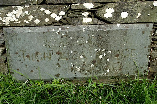 BWK88.jpg Plaque:- "C.C.C. / HIGH LIZA BRIDGE / 1965" (taken 16.5.2012) |
||
|
|
||
| evidence:- | old map:- OS County Series (Cmd 63 5) placename:- High Liza Bridge placename:- Liza Bridge, High |
|
| source data:- | Maps, County Series maps of Great Britain, scales 6 and 25
inches to 1 mile, published by the Ordnance Survey, Southampton,
Hampshire, from about 1863 to 1948. "High Liza Bridge" |
|
|
|
||
| evidence:- | old map:- Donald 1774 (Cmd) |
|
| source data:- | Map, hand coloured engraving, 3x2 sheets, The County of Cumberland, scale about 1
inch to 1 mile, by Thomas Donald, engraved and published by Joseph Hodskinson, 29
Arundel Street, Strand, London, 1774.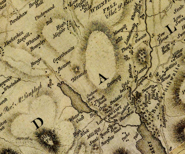 D4NY12SW.jpg double line across a river; a bridge at Cornhow item:- Carlisle Library : Map 2 Image © Carlisle Library |
|
|
|
||
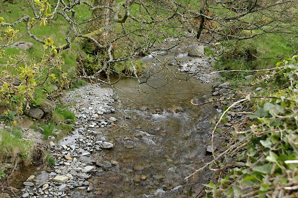 BWK89.jpg View of river. (taken 16.5.2012) |
||
|
|
||
 Lakes Guides menu.