 Old Cumbria Gazetteer
 |
 |
|
| milestone, Arthuret (2) | ||
| site name:- | road, Longtown to Newcastleton | |
| civil parish:- | Arthuret (formerly Cumberland) | |
| county:- | Cumbria | |
| locality type:- | milestone | |
| coordinates:- | NY39547083 | |
| 1Km square:- | NY3970 | |
| 10Km square:- | NY37 | |
|
|
||
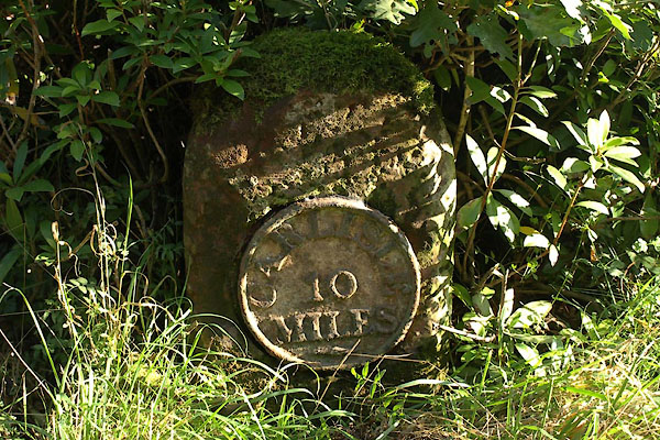 BZK13.jpg "CARLISLE / 10 / MILES" (taken 27.9.2013) |
||
|
|
||
| evidence:- | old map:- OS County Series (Cmd 6 15) |
|
| source data:- | Maps, County Series maps of Great Britain, scales 6 and 25
inches to 1 mile, published by the Ordnance Survey, Southampton,
Hampshire, from about 1863 to 1948. "M.S. Carlisle 10" |
|
|
|
||
| evidence:- | database:- Listed Buildings 2010 |
|
| source data:- | courtesy of English Heritage "MILESTONE SOUTH WEST OF NETHERBY HALL AT NGR 395 708 / / / ARTHURET / CARLISLE / CUMBRIA / II / 78108 / NY3953770847" |
|
| source data:- | courtesy of English Heritage "Milestone. Early C19, Longtown-Penton road. Red sandstone, cast iron plate. Round top stone has round cast plate to front CARLISLE 10 MILES. Whitewashed with lettering picked out in black." |
|
|
|
||
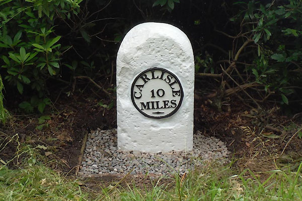 CEL65.jpg (taken 7.2015) courtesy of Terry Moore Image © Terry Moore |
||
|
|
||
 Lakes Guides menu.