 Old Cumbria Gazetteer
 |
 |
|
| milestone, Stanwix Rural (2) | ||
| site name:- | road, Carlisle to Brampton N | |
| locality:- | Crosbymoor | |
| civil parish:- | Stanwix Rural (formerly Cumberland) | |
| county:- | Cumbria | |
| locality type:- | milestone | |
| coordinates:- | NY46045987 | |
| 1Km square:- | NY4659 | |
| 10Km square:- | NY45 | |
|
|
||
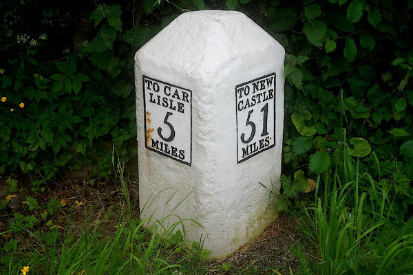 CFC30.jpg Cast iron plates on stone:- "TO CAR / LISLE / 5 / MILES" "TO NEW / CASTLE / 51 / MILES" (taken 10.6.2016) |
||
|
|
||
| evidence:- | old map:- OS County Series (Cmd 17 10) placename:- |
|
| source data:- | Maps, County Series maps of Great Britain, scales 6 and 25
inches to 1 mile, published by the Ordnance Survey, Southampton,
Hampshire, from about 1863 to 1948. "M.S. Carlisle 5. Newcastle 51." |
|
|
|
||
| evidence:- | old map:- Donald 1774 (Cmd) |
|
| source data:- | Map, hand coloured engraving, 3x2 sheets, The County of Cumberland, scale about 1
inch to 1 mile, by Thomas Donald, engraved and published by Joseph Hodskinson, 29
Arundel Street, Strand, London, 1774.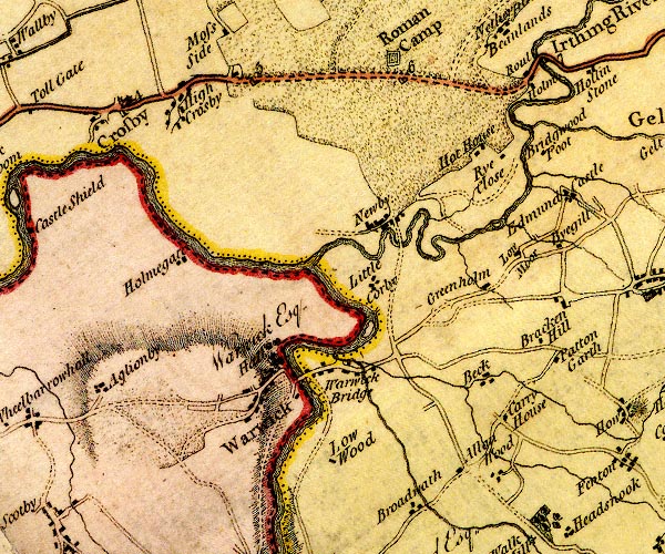 D4NY45NE.jpg "5" milestone; from Carlisle towards Newcastle item:- Carlisle Library : Map 2 Image © Carlisle Library |
|
|
|
||
| evidence:- | database:- Listed Buildings 2010 |
|
| source data:- | courtesy of English Heritage "MILESTONE (NORTH EAST OF CROSBY HOUSE) / / / STANWIX RURAL / CARLISLE / CUMBRIA / II / 77641 / NY4604859873" |
|
| source data:- | courtesy of English Heritage "Milestone. Probably 1758, for the Carlisie-Newcastle solitary Road. Sandstone, cast-iron plates. Chamfered stone to give 2 faces in direction of traffic, one face with cast plate TO CARLISLE 5 MILES, other face TO NEWCASTLE 51 MILES, both in 4 lines. Whitewashed over and lettering picked-out in black. In 1811 this became the Carlisle-Temon Turnpike. Each milestone is clearly drawn on Hodgskinson and Donald's map of Cumberland and Westmorland, surveyed 1770." |
|
|
|
||
 Lakes Guides menu.