 Old Cumbria Gazetteer
 |
 |
|
| milestone, Strickland Ketel (4) | ||
| site name:- | road, Kendal to Windermere | |
| civil parish:- | Strickland Ketel (formerly Westmorland) | |
| county:- | Cumbria | |
| locality type:- | milestone | |
| coordinates:- | SD49629513 | |
| 1Km square:- | SD4995 | |
| 10Km square:- | SD49 | |
| references:- | OS County Series |
|
|
|
||
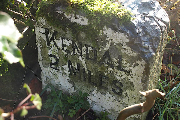 BTU59.jpg inscribed stone:- "KENDAL / 2 MILES" (taken 19.11.2010) 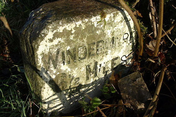 BTU60.jpg inscribed stone:- "WINDERMERE / 6½MILES" (taken 19.11.2010) |
||
|
|
||
| evidence:- | old map:- OS County Series (Wmd 33 15) |
|
| source data:- | Maps, County Series maps of Great Britain, scales 6 and 25
inches to 1 mile, published by the Ordnance Survey, Southampton,
Hampshire, from about 1863 to 1948. "M.S Ambleside .. 12 Kendal .. 2" |
|
|
|
||
| evidence:- | database:- Listed Buildings 2010 |
|
| source data:- | courtesy of English Heritage "MILESTONE ON LOOP ROAD 50 YARDS SOUTH OF JUNCTION OF HOLLINS LANE AND WINDERMERE / / / STRICKLAND KETEL / SOUTH LAKELAND / CUMBRIA / II / 76416 / SD4963095129" |
|
| source data:- | courtesy of English Heritage "Milestone, probably late C19. Limestone with chamfered edges. Painted white. Plain incised lettering painted black. North side: Kendal 2 miles. South side: Windermere 6 1/2 miles. Bench mark on side." |
|
|
|
||
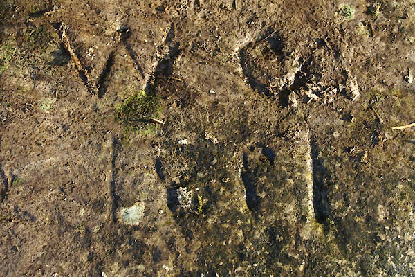 BTU61.jpg inscribed on top, perhaps sgraffito:- "W.[O] / 1[89]1" (taken 19.11.2010) |
||
|
|
||
 Lakes Guides menu.