 Old Cumbria Gazetteer
 |
 |
|
| Orton Beacon, Orton S | ||
| Orton Beacon | ||
| site name:- | Beacon Hill | |
| locality:- | Great Asby Scar | |
| civil parish:- | Asby (formerly Westmorland) | |
| county:- | Cumbria | |
| locality type:- | beacon | |
| coordinates:- | NY63490997 | |
| 1Km square:- | NY6309 | |
| 10Km square:- | NY60 | |
|
|
||
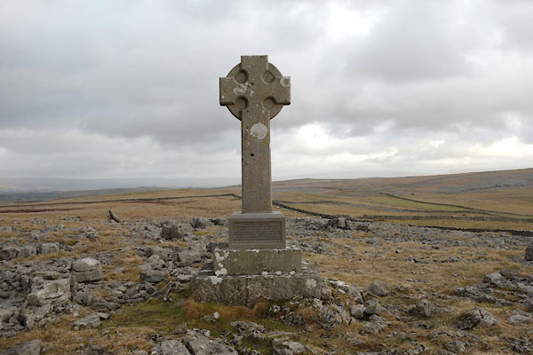 CCM72.jpg Beacon Monument. (taken 17.2.2015)  CCM73.jpg Beacon Monument. (taken 17.2.2015) |
||
|
|
||
| evidence:- | old map:- OS County Series placename:- Orton Beacon |
|
| source data:- | Maps, County Series maps of Great Britain, scales 6 and 25
inches to 1 mile, published by the Ordnance Survey, Southampton,
Hampshire, from about 1863 to 1948. "Orton Beacon" |
|
|
|
||
| evidence:- | old map:- Saxton 1579 |
|
| source data:- | Map, hand coloured engraving, Westmorlandiae et Cumberlandiae Comitatus ie Westmorland
and Cumberland, scale about 5 miles to 1 inch, by Christopher Saxton, London, engraved
by Augustinus Ryther, 1576, published 1579-1645.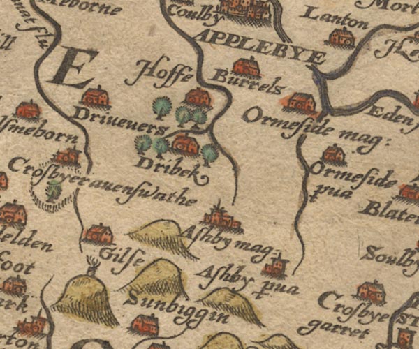 Sax9NY61.jpg NW of Sunbiggin; small tower with flames. item:- private collection : 2 Image © see bottom of page |
|
|
|
||
| evidence:- | old map:- Speed 1611 (Wmd) placename:- Beacon, The |
|
| source data:- | Map, hand coloured engraving, The Countie Westmorland and
Kendale the Cheif Towne, scale about 2.5 miles to 1 inch, by
John Speed, 1610, published by George Humble, Popes Head Alley,
London, 1611-12.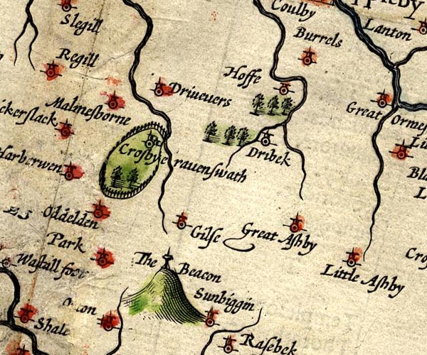 SP14NY61.jpg "The Beacon" post and cresset? on a hillock item:- Armitt Library : 2008.14.5 Image © see bottom of page |
|
|
|
||
| evidence:- | old map:- Jansson 1646 placename:- Beacon, The |
|
| source data:- | Map, hand coloured engraving, Cumbria and Westmoria, ie
Cumberland and Westmorland, scale about 3.5 miles to 1 inch, by
John Jansson, Amsterdam, Netherlands, 1646.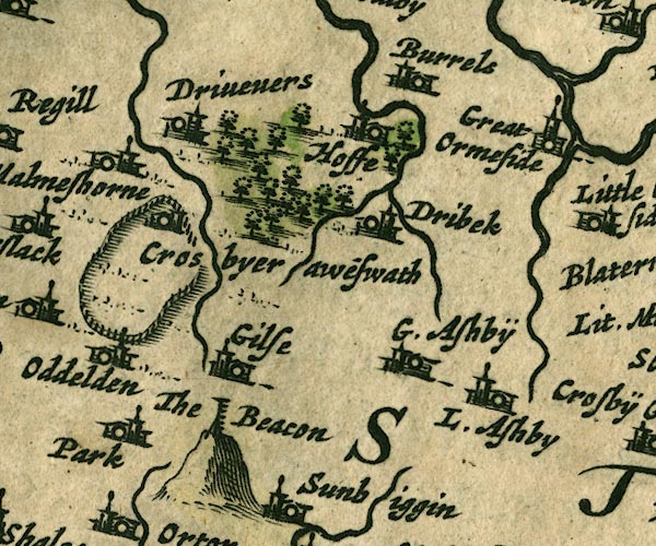 JAN3NY61.jpg "The Beacon" Hillock, post with ladder rungs etc. item:- JandMN : 88 Image © see bottom of page |
|
|
|
||
| evidence:- | old map:- Sanson 1679 |
|
| source data:- | Map, hand coloured engraving, Ancien Royaume de Northumberland
aujourdhuy Provinces de Nort, ie the Ancient Kingdom of
Northumberland or the Northern Provinces, scale about 9.5 miles
to 1 inch, by Nicholas Sanson, Paris, France, 1679. click to enlarge click to enlargeSAN2Cm.jpg ?obelisk on a hill item:- Dove Cottage : 2007.38.15 Image © see bottom of page |
|
|
|
||
| evidence:- | probably old map:- Morden 1695 (Wmd) placename:- Orton Beacon |
|
| source data:- | Map, hand coloured engraving, Westmorland, scale about 2.5 miles to 1 inch, by Robert
Morden, published by Abel Swale, the Unicorn, St Paul's Churchyard, Awnsham, and John
Churchill, the Black Swan, Paternoster Row, London, 1695.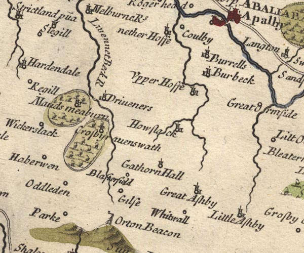 MD10NY61.jpg "Orton Beacon" Post with a cresset on a bracket, and a ladder up the side. item:- JandMN : 24 Image © see bottom of page |
|
|
|
||
| evidence:- | old map:- Bowen and Kitchin 1760 placename:- Beacon, The |
|
| source data:- | Map, hand coloured engraving, A New Map of the Counties of
Cumberland and Westmoreland Divided into their Respective Wards,
scale about 4 miles to 1 inch, by Emanuel Bowen and Thomas
Kitchin et al, published by T Bowles, Robert Sayer, and John
Bowles, London, 1760.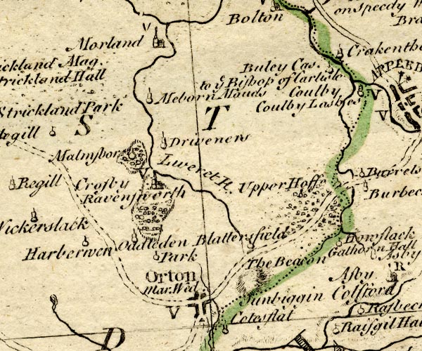 BO18NY51.jpg "The Beacon" hill hachuring item:- Armitt Library : 2008.14.10 Image © see bottom of page |
|
|
|
||
 Lakes Guides menu.