 Old Cumbria Gazetteer
 |
 |
|
| Rawthey Bridge, Sedbergh (2) | ||
| Rawthey Bridge | ||
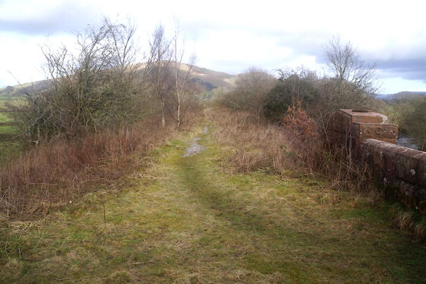
| site name:- | Low Gill and Ingleton branch railway | |
| site name:- | Rawthey, River | |
| civil parish:- | Sedbergh (formerly Yorkshire) | |
| county:- | Cumbria | |
| locality type:- | bridge | |
| coordinates:- | SD64309089 | |
| 1Km square:- | SD6490 | |
| 10Km square:- | SD69 | |
|
|
||
 CFV66.jpg (taken 24.2.2017) 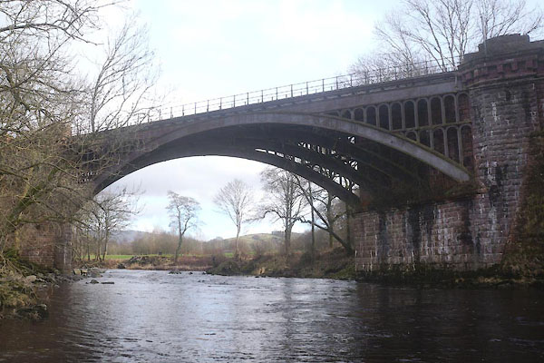 CFV64.jpg (taken 24.2.2017) |
||
|
|
||
| evidence:- | old map:- OS County Series (Yrk 63 3) placename:- Rawthey Bridge |
|
| source data:- | Maps, County Series maps of Great Britain, scales 6 and 25
inches to 1 mile, published by the Ordnance Survey, Southampton,
Hampshire, from about 1863 to 1948. "Rawthey Bridge" |
|
|
|
||
| evidence:- | database:- Listed Buildings 2010 placename:- Rawthey Bridge |
|
| source data:- | courtesy of English Heritage "RAWTHEY BRIDGE / / BRIGFLATTS / SEDBERGH / SOUTH LAKELAND / CUMBRIA / II / 484511 / SD6430190891" |
|
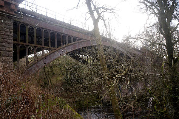
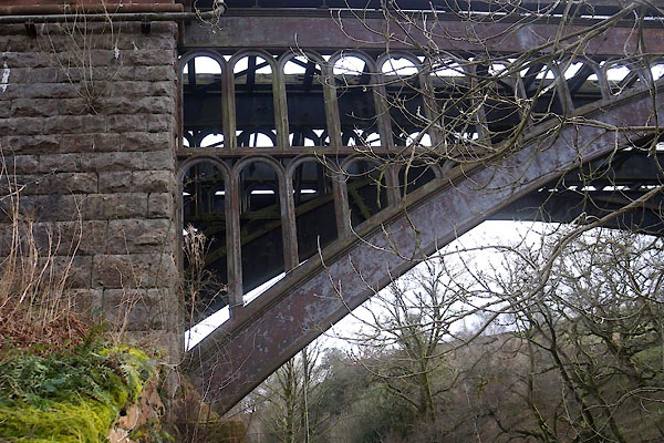
| source data:- | courtesy of English Heritage "Railway bridge over River Rawthey, now redundant. 1857-61, for the Lancaster and Carlisle Railway Company. Rusticated rock-faced sandstone, wrought-iron and cast-iron. Single span. Stone abutments and piers with chamfered angles and Doric entablatures, supporting 4 parallel segmental iron arches which have arcaded spandrels. Former iron parapet with ball-joints now missing." |
|
|
|
||
 CFV67.jpg (taken 24.2.2017) 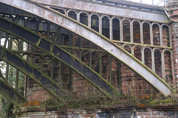 CFV68.jpg (taken 24.2.2017) 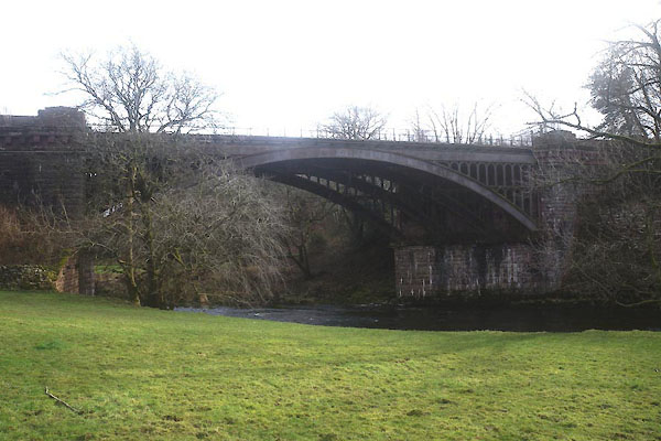 CFV65.jpg (taken 24.2.2017) |
||
|
|
||
 CFV69.jpg View N. (taken 24.2.2017) 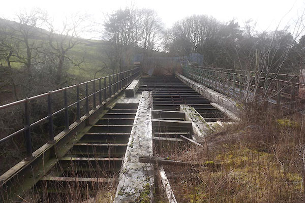 CFV70.jpg View S. (taken 24.2.2017) |
||
|
|
||
 Lakes Guides menu.