 Old Cumbria Gazetteer
 |
 |
|
| Scholar's Pool Bridge, Thursby | ||
| Scholar's Pool Bridge | ||
| civil parish:- | Thursby (formerly Cumberland) | |
| county:- | Cumbria | |
| locality type:- | bridge | |
| coordinates:- | NY26905159 | |
| 1Km square:- | NY2651 | |
| 10Km square:- | NY25 | |
|
|
||
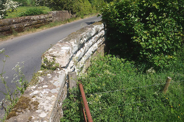 CGD84.jpg (taken 26.5.2017) |
||
|
|
||
| evidence:- | old map:- OS County Series (Cmd 22 14) placename:- Scholar's Pool Bridge |
|
| source data:- | Maps, County Series maps of Great Britain, scales 6 and 25
inches to 1 mile, published by the Ordnance Survey, Southampton,
Hampshire, from about 1863 to 1948. |
|
|
|
||
| evidence:- | probably old map:- Donald 1774 (Cmd) |
|
| source data:- | Map, hand coloured engraving, 3x2 sheets, The County of Cumberland, scale about 1
inch to 1 mile, by Thomas Donald, engraved and published by Joseph Hodskinson, 29
Arundel Street, Strand, London, 1774.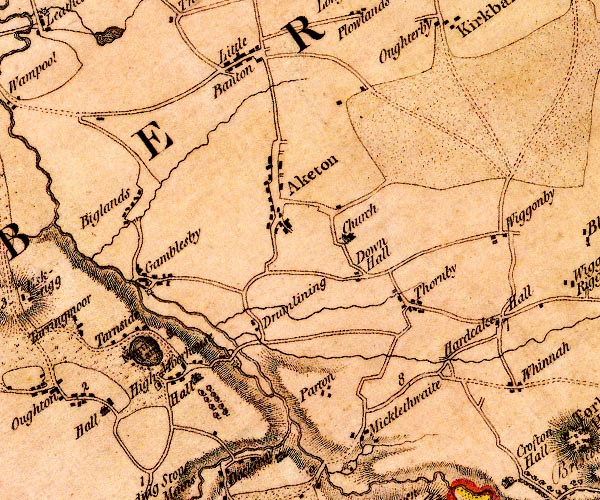 D4NY25SE.jpg double line across a river; a bridge SW of Drumleaning item:- Carlisle Library : Map 2 Image © Carlisle Library |
|
|
|
||
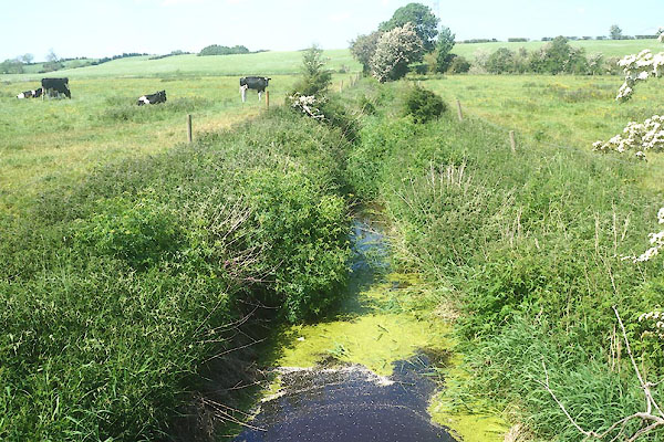 CGD85.jpg Beck. (taken 26.5.2017) |
||
|
|
||
 Lakes Guides menu.