 Old Cumbria Gazetteer
 |
 |
|
| Stennerskeugh Bridge, Stennerskeugh | ||
| Stennerskeugh Bridge | ||
| site name:- | Scandal Beck | |
| locality:- | Stennerskeugh | |
| civil parish:- | Ravenstonedale (formerly Westmorland) | |
| county:- | Cumbria | |
| locality type:- | bridge | |
| coordinates:- | NY74550176 | |
| 1Km square:- | NY7401 | |
| 10Km square:- | NY70 | |
|
|
||
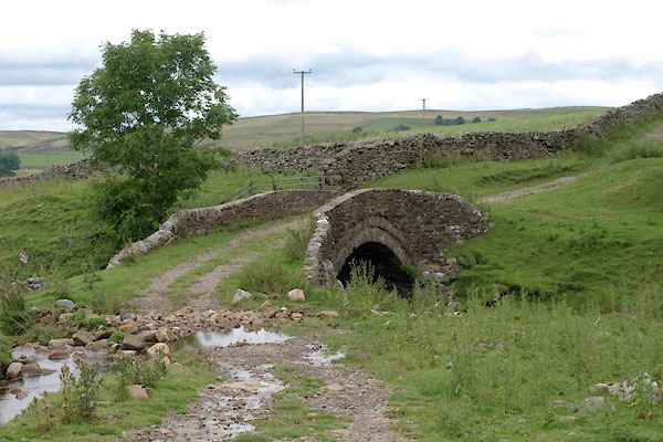 BYZ39.jpg (taken 6.8.2013) 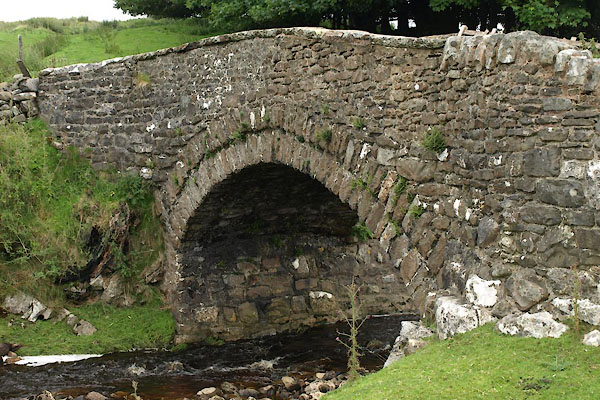 BYZ40.jpg (taken 6.8.2013) |
||
|
|
||
| evidence:- | old map:- OS County Series (Wmd 30 13) placename:- Stennerskeugh Bridge |
|
| source data:- | Maps, County Series maps of Great Britain, scales 6 and 25
inches to 1 mile, published by the Ordnance Survey, Southampton,
Hampshire, from about 1863 to 1948. |
|
|
|
||
| evidence:- | old map:- OS County Series (Wmd 30) placename:- Stennerskeugh Bridge |
|
| source data:- | Maps, County Series maps of Great Britain, scales 6 and 25
inches to 1 mile, published by the Ordnance Survey, Southampton,
Hampshire, from about 1863 to 1948. "Stennerskeugh Bridge" |
|
|
|
||
| evidence:- | database:- Listed Buildings 2010 |
|
| source data:- | courtesy of English Heritage "STENNERSKEUGH BRIDGE (AT NGR NY 746 018) / / A683 / RAVENSTONEDALE / EDEN / CUMBRIA / II / 74107 / NY7460001800" |
|
| source data:- | courtesy of English Heritage "Road bridge (fell track). Probably C18 (first mentioned 1745). Coursed rubble. Single semicircular arch spanning c.20 ft; roadway c.8 ft wide. Parapets are c.2 ft high with splayed ends; central sections have flat copings." |
|
|
|
||
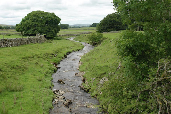 BYZ41.jpg View of river. (taken 6.8.2013) |
||
|
|
||
 Lakes Guides menu.