 Old Cumbria Gazetteer
 |
 |
|
| Toddell Bridge, Blindbothel | ||
| Toddell Bridge | ||
| site name:- | Sandy Beck | |
| locality:- | Toddell | |
| civil parish:- | Blindbothel (formerly Cumberland) | |
| county:- | Cumbria | |
| locality type:- | bridge | |
| coordinates:- | NY12232646 | |
| 1Km square:- | NY1226 | |
| 10Km square:- | NY12 | |
|
|
||
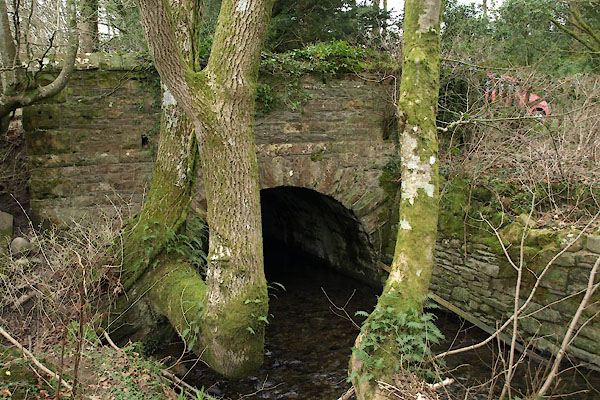 BWC42.jpg (taken 19.3.2012) 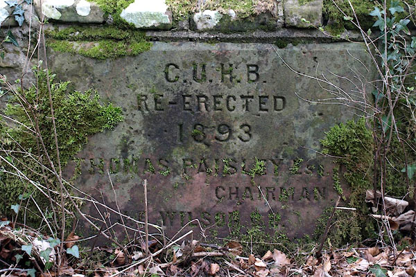 BWC43.jpg Plaque:- "C.U.H.B. / RE-ERECTED / 1893 / THOMAS PAISLEY ESQ. / [J. B.] WILSON [C.E.]" (taken 19.3.2012) |
||
|
|
||
| evidence:- | old map:- OS County Series (Cmd 54 16) placename:- Todal Bridge |
|
| source data:- | Maps, County Series maps of Great Britain, scales 6 and 25
inches to 1 mile, published by the Ordnance Survey, Southampton,
Hampshire, from about 1863 to 1948. |
|
|
|
||
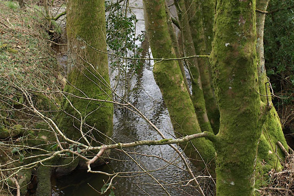 BWC44.jpg View of river. (taken 19.3.2012) |
||
|
|
||
 Lakes Guides menu.