 Old Cumbria Gazetteer
 |
 |
|
| Winnows, Longsleddale | ||
| locality:- | Dale End | |
| civil parish:- | Longsleddale (formerly Westmorland) | |
| county:- | Cumbria | |
| locality type:- | buildings | |
| coordinates:- | NY51750013 | |
| 1Km square:- | NY5100 | |
| 10Km square:- | NY50 | |
|
|
||
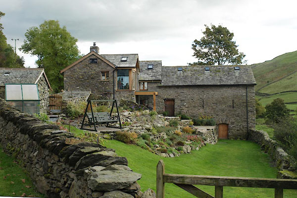 BXN73.jpg (taken 14.10.2012) 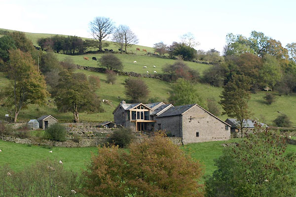 BXN51.jpg (taken 14.10.2012) |
||
| (The balcony not completed.) |
||
|
|
||
| evidence:- | old map:- OS County Series (Wmd 33 4) |
|
| source data:- | Maps, County Series maps of Great Britain, scales 6 and 25
inches to 1 mile, published by the Ordnance Survey, Southampton,
Hampshire, from about 1863 to 1948.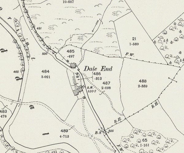 C5E025.jpg The building with the bench mark, across the road from Dale End, is now the Winnows. |
|
|
|
||
| evidence:- | old map:- Jefferys 1770 (Wmd) |
|
| source data:- | Map, 4 sheets, The County of Westmoreland, scale 1 inch to 1
mile, surveyed 1768, and engraved and published by Thomas
Jefferys, London, 1770.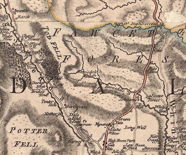 J5NY50SW.jpg circle, labelled in italic lowercase text; settlement, farm, house, or hamlet?, at Dale End item:- National Library of Scotland : EME.s.47 Image © National Library of Scotland |
|
|
|
||
| evidence:- | map:- OS Six Inch (1956) |
|
| source data:- | Map series, various editions with the national grid, scale about
6 inches to 1 mile, published by the Ordnance Survey,
Southampton, Hampshire, scale 1 to 10560 from 1950s to 1960s,
then 1 to 10000 from 1960s to 2000s, superseded by print on
demand from digital data.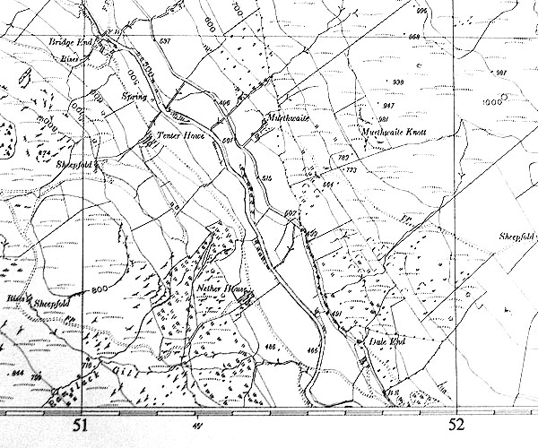 SINY5100.jpg |
|
|
|
||
 |
||
|
|
||
| |
||
|
|
||
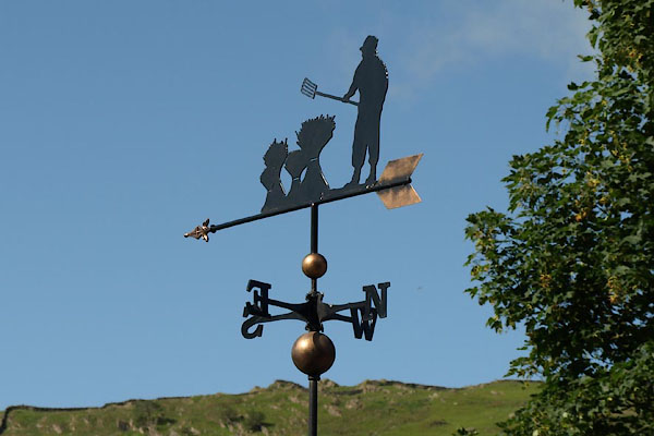 BUU42.jpg Weathervane - winnowing. (taken 20.6.2011) |
||
|
|
||
| see:- |  Dale End, Longsleddale Dale End, Longsleddale |
|
|
|
||
Lakes Guides menu.