 Old Cumbria Gazetteer
 |
 |
|
| Monks Bridge, Crosby Ravensworth | ||
| Monks Bridge | ||
| site name:- | Lyvennet Beck | |
| locality:- | Crosby Ravensworth | |
| civil parish:- | Crosby Ravensworth (formerly Westmorland) | |
| county:- | Cumbria | |
| locality type:- | bridge | |
| locality type:- | packhorse bridge (?) | |
| coordinates:- | NY62231491 | |
| 1Km square:- | NY6214 | |
| 10Km square:- | NY61 | |
|
|
||
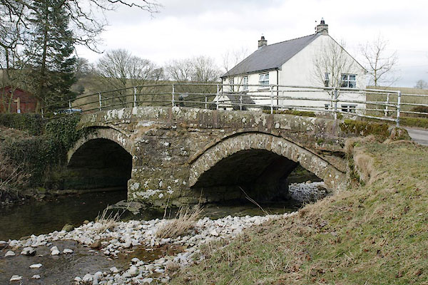 BSG67.jpg (taken 12.3.2010) |
||
|
|
||
| evidence:- | old map:- OS County Series (Wmd 14 16) placename:- Monk's Bridge |
|
| source data:- | Maps, County Series maps of Great Britain, scales 6 and 25
inches to 1 mile, published by the Ordnance Survey, Southampton,
Hampshire, from about 1863 to 1948. |
|
|
|
||
| evidence:- | database:- Listed Buildings 2010 placename:- Monks' Bridge |
|
| source data:- | courtesy of English Heritage "MONKS' BRIDGE OVER THE RIVER LYVENNET / / / CROSBY RAVENSWORTH / EDEN / CUMBRIA / II / 74032 / NY6223614906" |
|
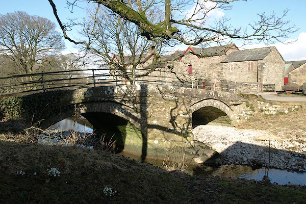
| source data:- | courtesy of English Heritage "Road bridge. First mentioned in 1702 but porbably C17; reputed locally to be connected with a nearby grange of Whitby Abbey. Underside suggests that it has been widened at some time. Coursed, squared rubble. 2 segmental arches, each spanning c.18 ft, with a central cutwater. Roadway is c.8 ft wide with low stone parapets topped by tubular railings which are not of interest." |
|
|
|
||
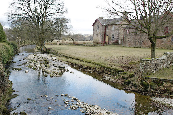 BSG69.jpg View of river. (taken 12.3.2010) |
||
|
|
||
 BSH50.jpg (taken 14.3.2010) 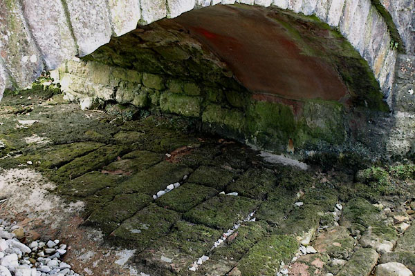 BSG68.jpg Protective masonry in the river bed; and evidence of bridge widening. (taken 12.3.2010) |
||
|
|
||
 Lakes Guides menu.