 Old Cumbria Gazetteer
 |
 |
|
| milestone, Westlinton | ||
| site name:- | road, Carlisle to Longtown | |
| civil parish:- | Westlinton (formerly Cumberland) | |
| county:- | Cumbria | |
| locality type:- | milestone | |
| coordinates:- | NY39646266 | |
| 1Km square:- | NY3962 | |
| 10Km square:- | NY36 | |
|
|
||
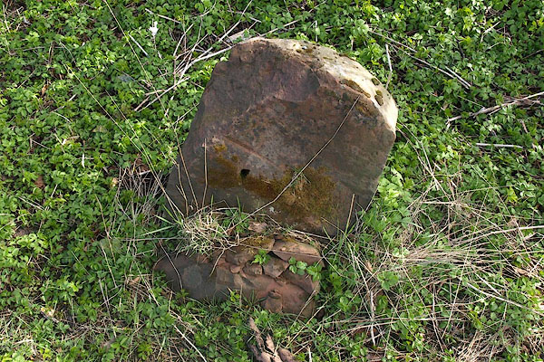 BSK22.jpg Defaced, or cast iron plates stolen? (taken 2.4.2010) |
||
|
|
||
| evidence:- | old map:- OS County Series (Cmd 16 3) |
|
| source data:- | Maps, County Series maps of Great Britain, scales 6 and 25
inches to 1 mile, published by the Ordnance Survey, Southampton,
Hampshire, from about 1863 to 1948. "M.S. Carlisle .. 4" |
|
|
|
||
| evidence:- | database:- Listed Buildings 2010 |
|
| source data:- | courtesy of English Heritage "MILESTONE AT NATIONAL GRID REFERENCE NY 39650 62650 / / / WESTLINTON / CARLISLE / CUMBRIA / II / 77977 / NY3964762653" |
|
| source data:- | courtesy of English Heritage "Milestone. Probably 1793 for Carlisle-Longtown Turnpike. Whitewashed red sandstone. Rounded top stone has circular recess on front for cast-iron plate now missing. Has painted black letters instead, CARLISLE 4 MILES. Bench mark on top." |
|
|
|
||
 Lakes Guides menu.