 Old Cumbria Gazetteer
 |
 |
|
| Archer Beck | ||
| locality:- | Archerbeck | |
| country:- | Scotland | |
| locality type:- | river | |
| 1Km square:- | NY4178 (etc) | |
| 10Km square:- | NY47 | |
|
|
||
| evidence:- | old map:- Burghley 1590 (facsimile) placename:- Archer Beck |
|
| source data:- | Facsimile map, A Platt of the Opposete Border of Scotland to ye West Marches of England,
parts of Cumberland and Scotland including the Debateable Land, from a manuscript
drawn for William Cecil, Lord Burghley, about 1590, published by R B Armstrong, 1897. courtesy of the National Library of Scotland 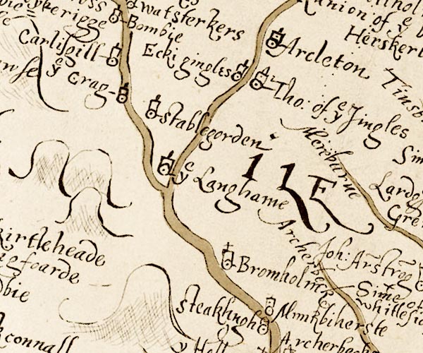 M048NY38.jpg "Archer beck" river item:- National Library of Scotland : MS6113 f.267 Image © National Library of Scotland |
|
|
|
||
| evidence:- | old map:- Donald 1774 (Cmd) placename:- Archer Burn |
|
| source data:- | Map, hand coloured engraving, 3x2 sheets, The County of Cumberland, scale about 1
inch to 1 mile, by Thomas Donald, engraved and published by Joseph Hodskinson, 29
Arundel Street, Strand, London, 1774.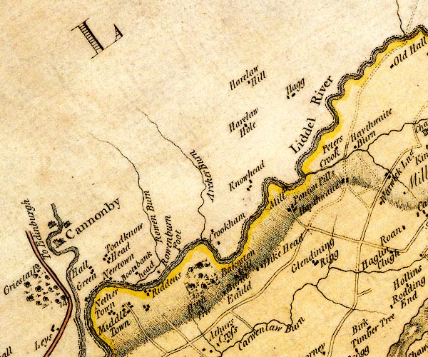 D4NY47NW.jpg "Archer Burn" single or double wiggly line; a river item:- Carlisle Library : Map 2 Image © Carlisle Library |
|
|
|
||
 Lakes Guides menu.