 Old Cumbria Gazetteer
 |
 |
|
| boundary stone, Mungrisdale (5) | ||
| civil parish:- | Mungrisdale (formerly Cumberland) | |
| county:- | Cumbria | |
| locality type:- | boundary stone | |
| locality type:- | parish boundary mark | |
| coordinates:- | NY36863115 | |
| 1Km square:- | NY3631 | |
| 10Km square:- | NY33 | |
| references:- | Listed Buildings 2010 |
|
|
|
||
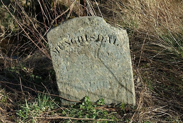 BWD75.jpg Stone:- "MUNGRISDALE" (taken 26.3.2012) |
||
|
|
||
| evidence:- | database:- Listed Buildings 2010 |
|
| source data:- | courtesy of English Heritage "BOUNDARY STONE SOUTH OF MOSS DYKE / / / MUNGRISDALE / EDEN / CUMBRIA / II / 73557 / NY3686331157" |
|
| source data:- | courtesy of English Heritage "Boundary stone. Early C.19. Greenslate. Rounded-top split slate stone set into bank at side of road inscribed MUNGRISDALE." |
|
|
|
||
| notes:- |
Note from Colin Smith, probably 1999. |
|
| Mungrisdale 00010 |
||
| OS County Series (Cmd 57 2) |
||
|
|
||
 Lakes Guides menu.