 Old Cumbria Gazetteer
 |
 |
|
| Burr Sand, Drigg and Carleton | ||
| Burr Sand | ||
| civil parish:- | Drigg and Carleton (formerly Cumberland) | |
| county:- | Cumbria | |
| locality type:- | foreshore | |
| 1Km square:- | SD0498 (etc) | |
| 10Km square:- | SD09 | |
| references:- | Bowen and Kitchin 1760 |
|
|
|
||
| evidence:- | old map:- Bowen and Kitchin 1760 placename:- Burr Sand |
|
| source data:- | Map, hand coloured engraving, A New Map of the Counties of
Cumberland and Westmoreland Divided into their Respective Wards,
scale about 4 miles to 1 inch, by Emanuel Bowen and Thomas
Kitchin et al, published by T Bowles, Robert Sayer, and John
Bowles, London, 1760.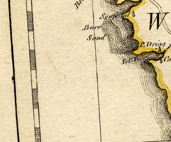 BO18SC99.jpg "Burr Sand" dotted area, foreshore sands item:- Armitt Library : 2008.14.10 Image © see bottom of page |
|
|
|
||
 Lakes Guides menu.