 Old Cumbria Gazetteer
 |
 |
|
| Cark: Fold | ||
| locality:- | Cark | |
| civil parish:- | Lower Holker (formerly Lancashire) | |
| county:- | Cumbria | |
| locality type:- | street | |
| locality type:- | pinfold (site?) | |
| coordinates:- | SD36277649 (etc) | |
| 1Km square:- | SD3676 | |
| 10Km square:- | SD37 | |
|
|
||
 BUE64.jpg (taken 4.3.2011) |
||
|
|
||
| evidence:- | database:- Listed Buildings 2010 |
|
| source data:- | courtesy of English Heritage "FORMER POST OFFICE / / THE FOLD / LOWER HOLKER / SOUTH LAKELAND / CUMBRIA / II / 77062 / SD3626476497" |
|
|
|
||
| evidence:- | database:- Listed Buildings 2010 |
|
| source data:- | courtesy of English Heritage "/ 1 AND 2 / THE FOLD / LOWER HOLKER / SOUTH LAKELAND / CUMBRIA / II / 77063 / SD3625276495" |
|
|
|
||
| evidence:- | database:- Listed Buildings 2010 |
|
| source data:- | courtesy of English Heritage "/ 3 AND 4 / THE FOLD / LOWER HOLKER / SOUTH LAKELAND / CUMBRIA / II / 77064 / SD3624476506" |
|
|
|
||
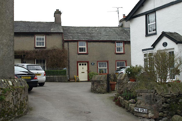
| observation:- |
The house at the start of the tiny street is The Fold, the houses at the further side
are One the Pound, Two the Pound, ... This suggests this might have been the site
of a pinfold, but nothing shows on the OS County series maps we have available. |
|
|
|
||
 Lakes Guides menu.