 Old Cumbria Gazetteer
 |
 |
|
| Castle Hill Education Settlement, Maryport | ||
| Castle Hill Education Settlement | ||
| Educational Establishment | ||
| Street:- | High Street | |
| locality:- | Maryport | |
| civil parish:- | Maryport (formerly Cumberland) | |
| county:- | Cumbria | |
| locality type:- | buildings | |
| locality type:- | school (?) | |
| coordinates:- | NY03433632 | |
| 1Km square:- | NY0336 | |
| 10Km square:- | NY03 | |
| references:- | Listed Buildings 2010 |
|
|
|
||
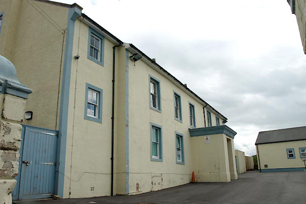 BWI89.jpg (taken 4.5.2012) 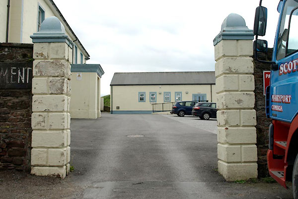 BWI90.jpg Gate. (taken 4.5.2012) |
||
|
|
||
| evidence:- | old map:- OS County Series (Cmd 44 8) placename:- Castle Hill House |
|
| source data:- | Maps, County Series maps of Great Britain, scales 6 and 25
inches to 1 mile, published by the Ordnance Survey, Southampton,
Hampshire, from about 1863 to 1948. |
|
|
|
||
| evidence:- | database:- Listed Buildings 2010 placename:- Castle Hill Education Settlement |
|
| source data:- | courtesy of English Heritage "CASTLE HILL EDUCATION SETTLEMENT / / HIGH STREET / MARYPORT / ALLERDALE / CUMBRIA / II / 71825 / NY0343136323" |
|
|
|
||
| evidence:- | database:- Listed Buildings 2010 |
|
| source data:- | courtesy of English Heritage "GATEPIERS AND GATES TO CASTLE HILL EDUCATION SETTLEMENT / / HIGH STREET / MARYPORT / ALLERDALE / CUMBRIA / II / 71826 / NY0342436347" |
|
|
|
||
 Lakes Guides menu.