 Old Cumbria Gazetteer
 |
 |
|
| Church Bridge, Bampton Grange | ||
| Church Bridge | ||
| site name:- | Lowther, River | |
| locality:- | Bampton Grange | |
| civil parish:- | Bampton (formerly Westmorland) | |
| county:- | Cumbria | |
| locality type:- | bridge | |
| coordinates:- | NY52071801 | |
| 1Km square:- | NY5218 | |
| 10Km square:- | NY51 | |
| references:- | Listed Buildings 2010 |
|
|
|
||
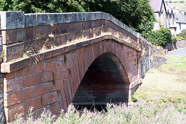 BJT75.jpg (taken 22.8.2005) 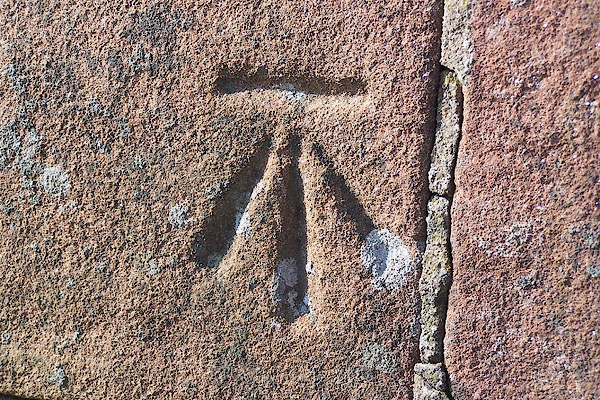 BNK40.jpg Bench mark on the bridge parapet. (taken 23.3.2007) |
||
|
|
||
| evidence:- | old map:- Jefferys 1770 (Wmd) |
|
| source data:- | Map, 4 sheets, The County of Westmoreland, scale 1 inch to 1
mile, surveyed 1768, and engraved and published by Thomas
Jefferys, London, 1770.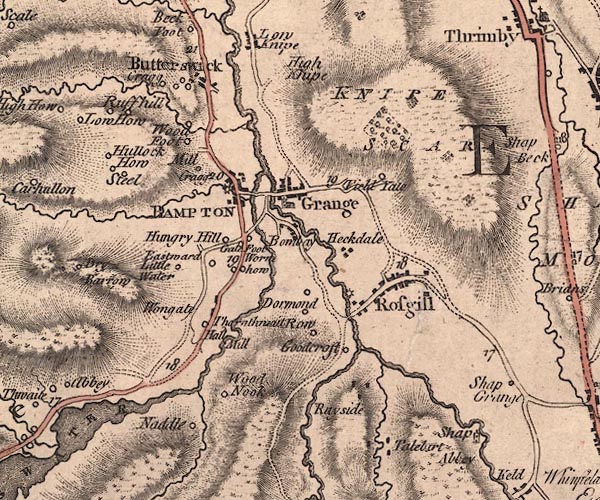 J5NY51NW.jpg double line, road, across a stream; bridge item:- National Library of Scotland : EME.s.47 Image © National Library of Scotland |
|
|
|
||
| evidence:- | old map:- Cary 1789 (edn 1805) |
|
| source data:- | Map, uncoloured engraving, Westmoreland, scale about 2.5 miles
to 1 inch, by John Cary, London, 1789; edition 1805.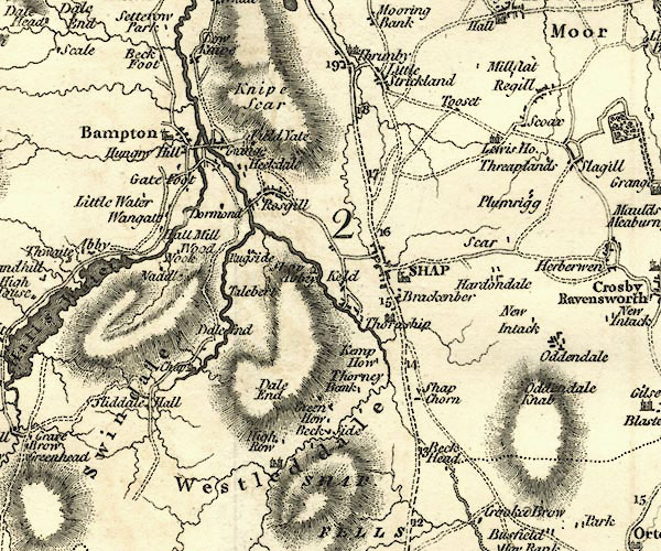 CY24NY51.jpg road across a stream; bridge over the Lowther item:- JandMN : 129 Image © see bottom of page |
|
|
|
||
| evidence:- | old print:- Bradley 1901 |
|
| source data:- | Print, uncoloured lithograph, Near Bampton, Church Bridge, Bampton Grange, Westmorland,
by Joseph Pennell, published by Macmillan and Co, London, 1901.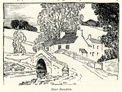 click to enlarge click to enlargeBRL182.jpg On page 308 of Highways and Byways in the Lake District, by A G Bradley. printed at lower centre:- "Joseph Pennell" printed at bottom:- "Near Bampton." item:- JandMN : 464.82 Image © see bottom of page |
|
|
|
||
| evidence:- | database:- Listed Buildings 2010 placename:- Church Bridge |
|
| source data:- | courtesy of English Heritage "CHURCH BRIDGE / / BAMPTON GRANGE / BAMPTON / EDEN / CUMBRIA / II / 74484 / NY5207018010" |
|
| source data:- | courtesy of English Heritage "Roadbridge. Late C18 or early C19. Dressed red sandstone. Segmental-arch with rusticated voussoirs, string course and chamfered parapet. Narrow with slight hump. Parapet coping is a C19 addition." |
|
|
|
||
 Lakes Guides menu.