 Old Cumbria Gazetteer
 |
 |
|
| Crook Mill, Crook | ||
| Crook Mill | ||
| site name:- | Eller Beck (8) | |
| Street:- | Dobby Lane | |
| locality:- | Crook | |
| civil parish:- | Crook (formerly Westmorland) | |
| county:- | Cumbria | |
| locality type:- | buildings | |
| locality type:- | buildings | |
| locality type:- | mill (ex) | |
| locality type:- | water mill | |
| locality type:- | textile mill (woollen) | |
| locality type:- | bobbin mill (once) | |
| coordinates:- | SD46129508 | |
| 1Km square:- | SD4695 | |
| 10Km square:- | SD49 | |
|
|
||
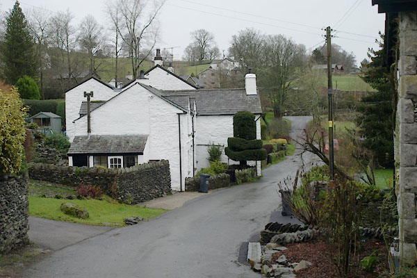 BVT48.jpg (taken 23.12.2011) 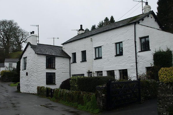 BVT51.jpg Millbeck cottages, once workers' accommodation. (taken 23.12.2011) |
||
|
|
||
| evidence:- | old map:- OS County Series (Wmd 33 14) placename:- Crook Mill |
|
| source data:- | Maps, County Series maps of Great Britain, scales 6 and 25
inches to 1 mile, published by the Ordnance Survey, Southampton,
Hampshire, from about 1863 to 1948. "Crook Mill (Woollen) / Mill Dam" |
|
|
|
||
| evidence:- | old map:- Jefferys 1770 (Wmd) |
|
| source data:- | Map, 4 sheets, The County of Westmoreland, scale 1 inch to 1
mile, surveyed 1768, and engraved and published by Thomas
Jefferys, London, 1770.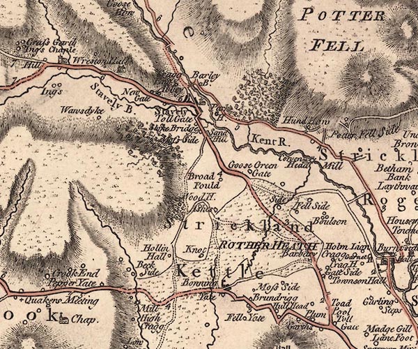 J5SD49NE.jpg circle with rays; water mill item:- National Library of Scotland : EME.s.47 Image © National Library of Scotland |
|
|
|
||
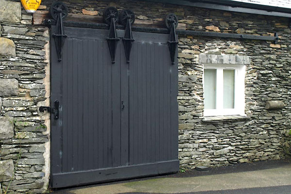 BVT49.jpg Warehouse door. (taken 23.12.2011) 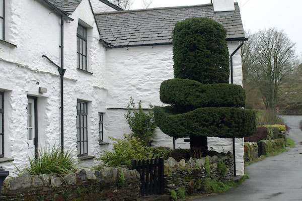 BVT50.jpg Topiary. (taken 23.12.2011) |
||
|
|
||
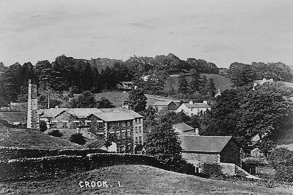 BVD94.jpg courtesy of Deirdre Linton 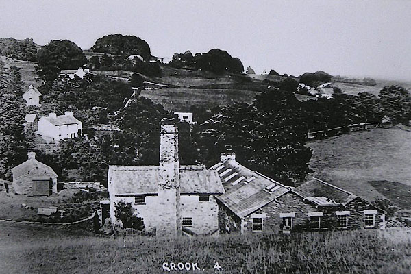 BVD95.jpg courtesy of Deirdre Linton |
||
| The larger mill buildings have all gone. |
||
|
|
||
| notes:- |
The mill was owned by the Harrison Family from about 1841 to its closure in 1909. |
|
| The mill dam was at SD46079522. |
||
|
|
||
| Somervell, John: 1930: Water Power Mills of South Westmorland |
||
|
|
||
 Lakes Guides menu.