 Old Cumbria Gazetteer
 |
 |
|
| Dumfries, Scotland | ||
| Dumfries | ||
| country:- | Scotland | |
| locality type:- | buildings | |
| 1Km square:- | NX9675 | |
| 10Km square:- | NX97 | |
|
|
||
| evidence:- | old map:- Burghley 1590 (facsimile) placename:- Dunfreise |
|
| source data:- | Facsimile map, A Platt of the Opposete Border of Scotland to ye West Marches of England,
parts of Cumberland and Scotland including the Debateable Land, from a manuscript
drawn for William Cecil, Lord Burghley, about 1590, published by R B Armstrong, 1897. courtesy of the National Library of Scotland 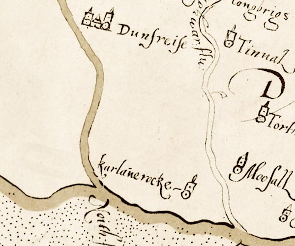 M048NY07.jpg "Dunfreise" circle, 2 or 3 towers item:- National Library of Scotland : MS6113 f.267 Image © National Library of Scotland |
|
|
|
||
| evidence:- | old map:- Speed 1611 (Cum/EW) placename:- Dumfres |
|
| source data:- | Map, hand coloured engraving, Kingdome of Great Britaine and
Ireland, scale about 36 miles to 1 inch, by John Speed, about
1610-11, published by Thomas Bassett, Fleet Street and Richard
Chiswell, St Paul's Churchyard, London, 1676?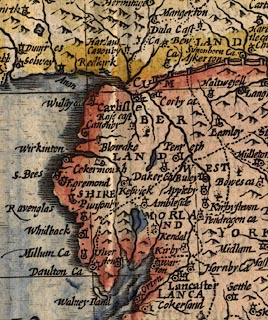 click to enlarge click to enlargeSPD6Cm.jpg "Dumfres" dot, circle, and tower item:- private collection : 85 Image © see bottom of page |
|
|
|
||
 Lakes Guides menu.