 Old Cumbria Gazetteer
 |
 |
|
| Greena Tower, Scotland | ||
| gone | ||
| Greena Tower | ||
| country:- | Scotland | |
| locality type:- | tower (site) | |
| coordinates:- | NY46168076 | |
| 1Km square:- | NY4680 | |
| 10Km square:- | NY48 | |
|
|
||
| evidence:- | old map:- OS County Series (Rox 48) placename:- Greena Tower |
|
| source data:- | Maps, County Series maps of Great Britain, scales 6 and 25
inches to 1 mile, published by the Ordnance Survey, Southampton,
Hampshire, from about 1863 to 1948. "Site of Greena Tower" |
|
|
|
||
| evidence:- | old map:- Burghley 1590 (facsimile) placename:- Grenehag |
|
| source data:- | Facsimile map, A Platt of the Opposete Border of Scotland to ye West Marches of England,
parts of Cumberland and Scotland including the Debateable Land, from a manuscript
drawn for William Cecil, Lord Burghley, about 1590, published by R B Armstrong, 1897. courtesy of the National Library of Scotland 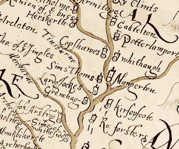 M048NY48.jpg "Grenehag" circle, tower item:- National Library of Scotland : MS6113 f.267 Image © National Library of Scotland |
|
|
|
||
| evidence:- | perhaps old map:- Donald 1774 (Cmd) placename:- Greenah Hill |
|
| source data:- | Map, hand coloured engraving, 3x2 sheets, The County of Cumberland, scale about 1
inch to 1 mile, by Thomas Donald, engraved and published by Joseph Hodskinson, 29
Arundel Street, Strand, London, 1774.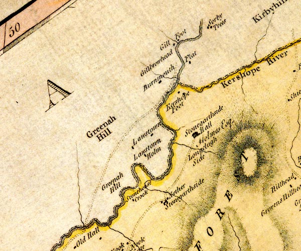 D4NY48SE.jpg "Greenah Hill" block or blocks, labelled in lowercase; a hamlet or just a house item:- Carlisle Library : Map 2 Image © Carlisle Library |
|
|
|
||
 Lakes Guides menu.