 Old Cumbria Gazetteer
 |
 |
|
| High Bewaldeth Cottage, Bewaldeth and Snittlegarth | ||
| High Bewaldeth Cottage | ||
| locality:- | High Bewaldeth | |
| civil parish:- | Bewaldeth and Snittlegarth (formerly Cumberland) | |
| county:- | Cumbria | |
| locality type:- | buildings | |
| coordinates:- | NY22373418 | |
| 1Km square:- | NY2234 | |
| 10Km square:- | NY23 | |
|
|
||
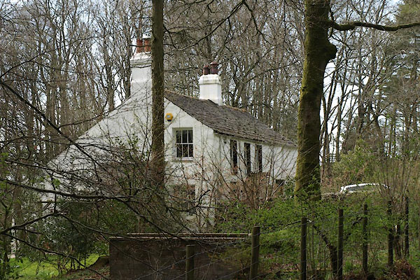 BYH57.jpg (taken 2.5.2013) |
||
|
|
||
| evidence:- | old map:- OS County Series (Cmd 46 12) placename:- Gill |
|
| source data:- | Maps, County Series maps of Great Britain, scales 6 and 25
inches to 1 mile, published by the Ordnance Survey, Southampton,
Hampshire, from about 1863 to 1948. |
|
|
|
||
| evidence:- | old map:- Donald 1774 (Cmd) placename:- Gill |
|
| source data:- | Map, hand coloured engraving, 3x2 sheets, The County of Cumberland, scale about 1
inch to 1 mile, by Thomas Donald, engraved and published by Joseph Hodskinson, 29
Arundel Street, Strand, London, 1774.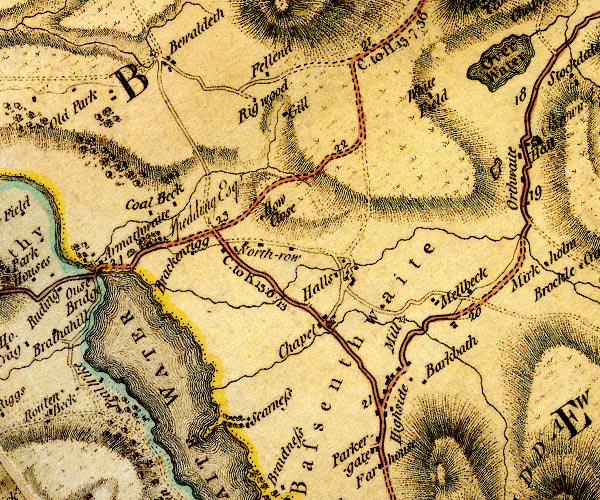 D4NY23SW.jpg "Gill" block or blocks, labelled in lowercase; a hamlet or just a house item:- Carlisle Library : Map 2 Image © Carlisle Library |
|
|
|
||
| evidence:- | database:- Listed Buildings 2010 placename:- High Bewaldeth Cottage |
|
| source data:- | courtesy of English Heritage "HIGH BEWALDETH COTTAGE AND ADJOINING FORMER STABLE / / / BEWALDETH AND SNITTLEGARTH / ALLERDALE / CUMBRIA / II / 72116 / NY2237334182" |
|
|
|
||
 Lakes Guides menu.