 Old Cumbria Gazetteer
 |
 |
|
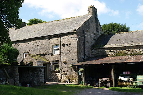
| High Stennerskeugh, Stennerskeugh | ||
| High Stennerskeugh | ||
| locality:- | Stennerskeugh | |
| civil parish:- | Ravenstonedale (formerly Westmorland) | |
| county:- | Cumbria | |
| locality type:- | buildings | |
| coordinates:- | NY74710127 | |
| 1Km square:- | NY7401 | |
| 10Km square:- | NY70 | |
|
|
||
 BTI81.jpg (taken 16.8.2010) 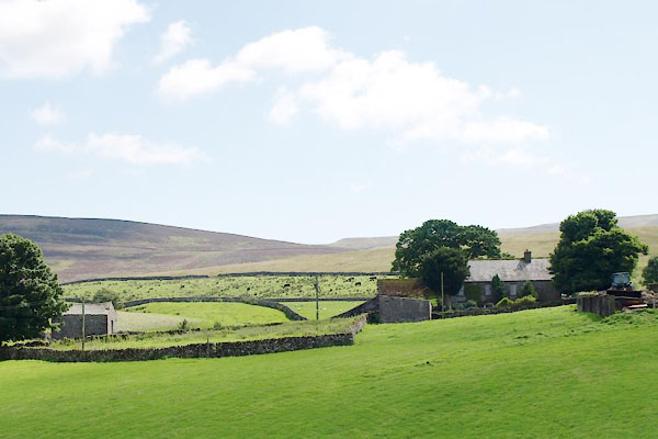 BTI82.jpg (taken 16.8.2010) |
||
|
|
||
| evidence:- | old map:- OS County Series (Wmd 30 14) placename:- High Stennerskeugh placename:- Stennerskeugh, High |
|
| source data:- | Maps, County Series maps of Great Britain, scales 6 and 25
inches to 1 mile, published by the Ordnance Survey, Southampton,
Hampshire, from about 1863 to 1948. |
|
|
|
||
| evidence:- | old map:- Jefferys 1770 (Wmd) placename:- Stenhouseskers |
|
| source data:- | Map, 4 sheets, The County of Westmoreland, scale 1 inch to 1
mile, surveyed 1768, and engraved and published by Thomas
Jefferys, London, 1770.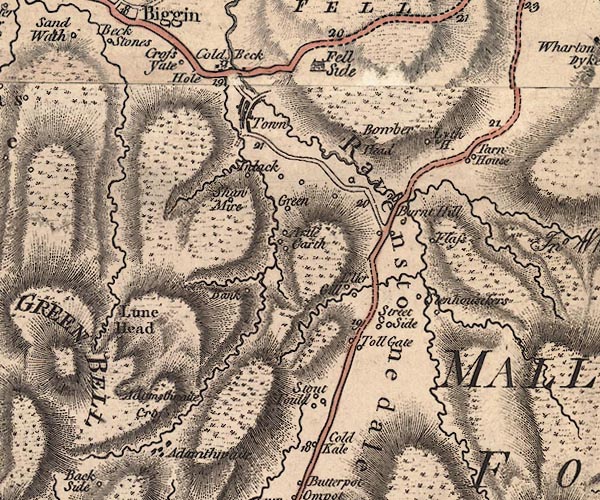 J5NY70SW.jpg "Stenhouseskers" circle, labelled in italic lowercase text; settlement, farm, house, or hamlet? item:- National Library of Scotland : EME.s.47 Image © National Library of Scotland |
|
|
|
||
| evidence:- | database:- Listed Buildings 2010 placename:- High Stennerskeugh Farm |
|
| source data:- | courtesy of English Heritage "HIGH STENNERSKEUGH FARMHOUSE AND ADJOINING BYRE / / A683 / RAVENSTONEDALE / EDEN / CUMBRIA / II / 74111 / NY7440901586" |
|
|
|
||
 Lakes Guides menu.