 Old Cumbria Gazetteer
 |
 |
|
| Hoff Row, Hoff | ||
| Hoff Row | ||
| locality:- | Hoff Row | |
| civil parish:- | Hoff (formerly Westmorland) | |
| county:- | Cumbria | |
| locality type:- | buildings | |
| coordinates:- | NY67091752 | |
| 1Km square:- | NY6717 | |
| 10Km square:- | NY61 | |
| references:- | Listed Buildings 2010 |
|
|
|
||
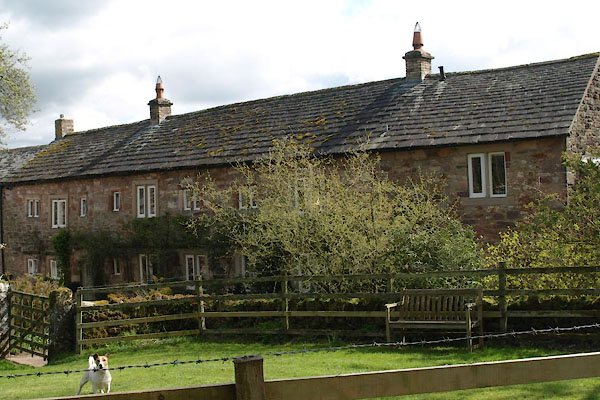 BWF64.jpg (taken 13.4.2012) 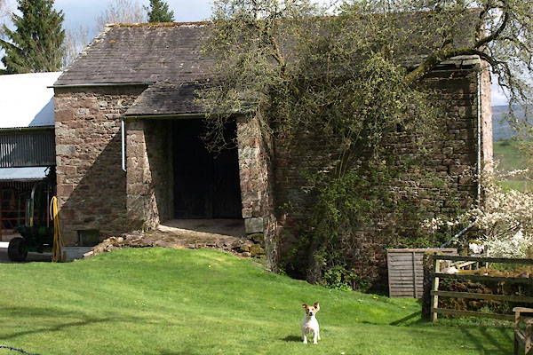 BWF65.jpg Barn close by. (taken 13.4.2012) |
||
|
|
||
| evidence:- | old map:- OS County Series (Wmd 15 6) placename:- Hoff Row |
|
| source data:- | Maps, County Series maps of Great Britain, scales 6 and 25
inches to 1 mile, published by the Ordnance Survey, Southampton,
Hampshire, from about 1863 to 1948. |
|
|
|
||
| evidence:- | old map:- Jefferys 1770 (Wmd) placename:- Hough Row |
|
| source data:- | Map, 4 sheets, The County of Westmoreland, scale 1 inch to 1
mile, surveyed 1768, and engraved and published by Thomas
Jefferys, London, 1770.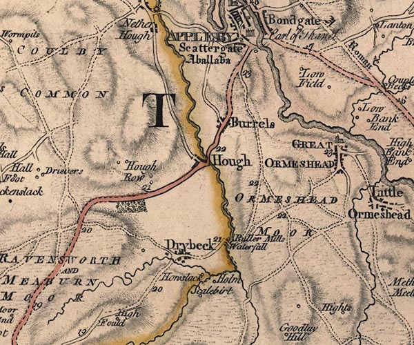 J5NY61NE.jpg "Hough Row" circle, labelled in italic lowercase text; settlement, farm, house, or hamlet? item:- National Library of Scotland : EME.s.47 Image © National Library of Scotland |
|
|
|
||
| evidence:- | old map:- Cary 1789 (edn 1805) placename:- Hough Row |
|
| source data:- | Map, uncoloured engraving, Westmoreland, scale about 2.5 miles
to 1 inch, by John Cary, London, 1789; edition 1805.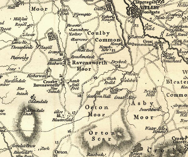 CY24NY61.jpg "Hough Row" block/s, labelled in italic lowercase; house, or hamlet item:- JandMN : 129 Image © see bottom of page |
|
|
|
||
| evidence:- | database:- Listed Buildings 2010 placename:- Hoff Row item:- date stone (1695) |
|
| source data:- | courtesy of English Heritage "HOFF ROW ADJOINING STABLE AND ADDITION TO SOUTH / / / HOFF / EDEN / CUMBRIA / II / 73277 / NY6709217520" |
|
|
|
||
 Lakes Guides menu.