 Old Cumbria Gazetteer
 |
 |
|
| How End Farm, Thursby | ||
| How End Farm | ||
| locality:- | How Hill | |
| locality:- | Howend | |
| civil parish:- | Thursby (formerly Cumberland) | |
| county:- | Cumbria | |
| locality type:- | buildings | |
| coordinates:- | NY31544978 | |
| 1Km square:- | NY3149 | |
| 10Km square:- | NY34 | |
| references:- | Listed Buildings 2010 |
|
|
|
||
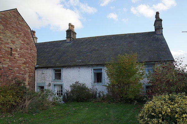 BZP42.jpg (taken 1.11.2013) 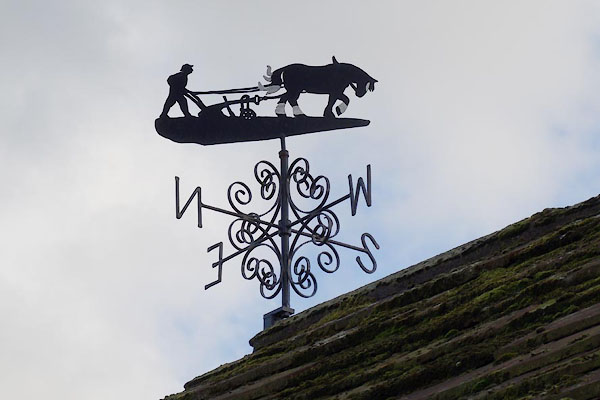 BZP44.jpg Weathervane. (taken 1.11.2013) |
||
|
|
||
| evidence:- | old map:- OS County Series (Cmd 29 4) placename:- Howend |
|
| source data:- | Maps, County Series maps of Great Britain, scales 6 and 25
inches to 1 mile, published by the Ordnance Survey, Southampton,
Hampshire, from about 1863 to 1948. |
|
|
|
||
| evidence:- | old map:- Ogilby 1675 (plate 96) |
|
| source data:- | Road strip map, hand coloured engraving, the Road from Kendal to
Cockermouth, and the Road from Egremond to Carlisle, scale about
1 inch to 1 mile, by John Ogilby, London, 1675.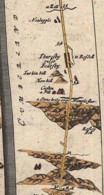 OG96Bm30.jpg In mile 33, Cumberland. Houses to the right of the road. item:- JandMN : 22 Image © see bottom of page |
|
|
|
||
| evidence:- | old map:- Donald 1774 (Cmd) placename:- How |
|
| source data:- | Map, hand coloured engraving, 3x2 sheets, The County of Cumberland, scale about 1
inch to 1 mile, by Thomas Donald, engraved and published by Joseph Hodskinson, 29
Arundel Street, Strand, London, 1774.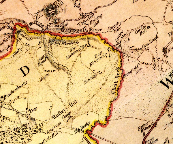 D4NY34NW.jpg "How" block or blocks, labelled in lowercase; a hamlet or just a house item:- Carlisle Library : Map 2 Image © Carlisle Library |
|
|
|
||
| evidence:- | database:- Listed Buildings 2010 placename:- How End Farm item:- date stone (1764) |
|
| source data:- | courtesy of English Heritage "HOW END FARMHOUSE AND ADJOINING BARNS / / / / ALLERDALE / CUMBRIA / II / 71929 / NY3154849786" |
|
|
|
||
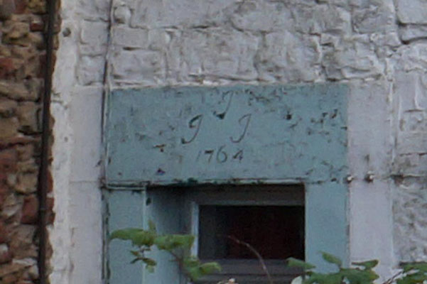 BZP43.jpg Date stone:- "J / J J / 1764" (taken 1.11.2013) |
||
|
|
||
 Lakes Guides menu.