 Old Cumbria Gazetteer
 |
 |
|
| Loughrigg Fold, Loughrigg | ||
| Loughrigg Fold | ||
| locality:- | Loughrigg | |
| civil parish:- | Lakes (formerly Westmorland) | |
| county:- | Cumbria | |
| locality type:- | buildings | |
| coordinates:- | NY34130434 | |
| 1Km square:- | NY3404 | |
| 10Km square:- | NY30 | |
|
|
||
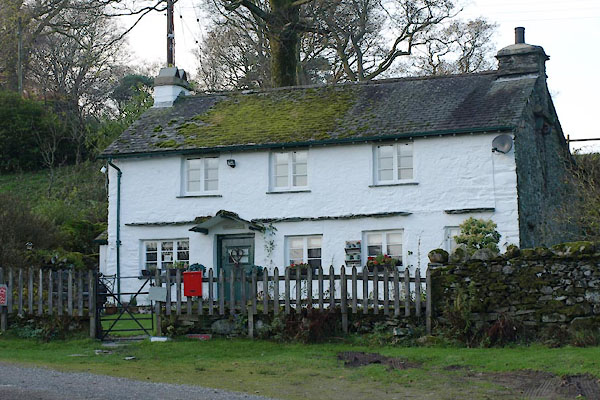 BVR51.jpg (taken 15.11.2011) 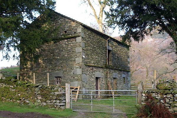 BVR52.jpg Barn. (taken 15.11.2011) |
||
|
|
||
| evidence:- | old map:- OS County Series (Wmd 26 9) placename:- Loughrigg Fold |
|
| source data:- | Maps, County Series maps of Great Britain, scales 6 and 25
inches to 1 mile, published by the Ordnance Survey, Southampton,
Hampshire, from about 1863 to 1948. |
|
|
|
||
| evidence:- | hearth tax returns:- Hearth Tax 1675 placename:- Fold |
|
| source data:- | Records, hearth tax survey returns, Westmorland, 1674/75. "Fold" in "Loughrigge and Rydall" |
|
|
|
||
| evidence:- | old map:- Jefferys 1770 (Wmd) placename:- Foulds |
|
| source data:- | Map, 4 sheets, The County of Westmoreland, scale 1 inch to 1
mile, surveyed 1768, and engraved and published by Thomas
Jefferys, London, 1770.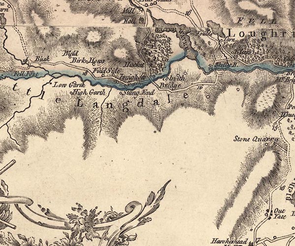 J5NY30SW.jpg "Foulds" no symbol item:- National Library of Scotland : EME.s.47 Image © National Library of Scotland |
|
|
|
||
| evidence:- | old print:- Green 1822 (plate 11) placename:- Loughrigg Fold item:- chimney top |
|
| source data:- | Print, uncoloured soft ground etching, Loughrigg Fold, Loughrigg, Westmorland, by
William Green, Ambleside, Westmorland, 1822.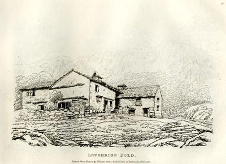 click to enlarge click to enlargeGN0811.jpg Plate 11 in Forty Etchings from Nature. printed at bottom:- "LOUGHRIGG FOLD. / Etched from Nature by William Green, &Published at Ambleside, Feby. 1, 1822." item:- Armitt Library : A6644.11 Image © see bottom of page |
|
|
|
||
| evidence:- | database:- Listed Buildings 2010 placename:- Loughrigg Fold |
|
| source data:- | courtesy of English Heritage "LOUGHRIGG FOLD / / / LAKES / SOUTH LAKELAND / CUMBRIA / II / 452634 / NY3413604343" |
|
|
|
||
 Lakes Guides menu.