 Old Cumbria Gazetteer
 |
 |
|
| Low Gardens Bridge, Lowther Park | ||
| Low Gardens Bridge | ||
| site name:- | Lowther, River | |
| locality:- | Lowther Park | |
| civil parish:- | Lowther (formerly Westmorland) | |
| civil parish:- | Yanwath and Eamont Bridge (formerly Westmorland) | |
| county:- | Cumbria | |
| locality type:- | bridge | |
| coordinates:- | NY52102502 | |
| 1Km square:- | NY5225 | |
| 10Km square:- | NY52 | |
| references:- | Listed Buildings 2010 |
|
|
|
||
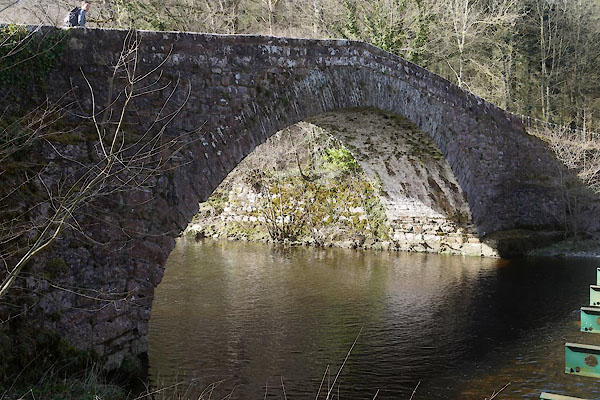 CFY54.jpg (taken 26.3.2017) 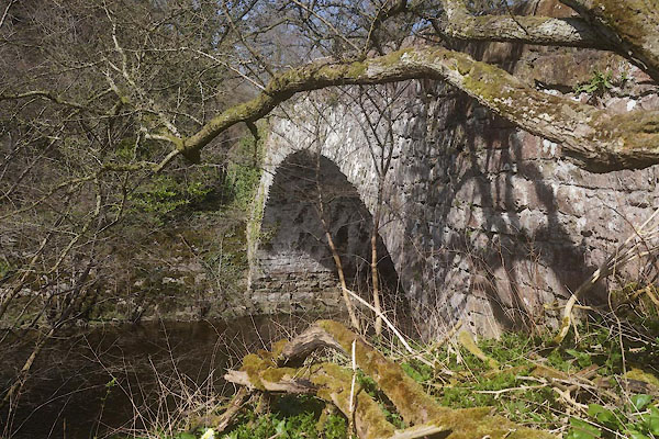 CFY53.jpg (taken 26.3.2017) |
||
|
|
||
| evidence:- | old map:- OS County Series (Wmd 7 8) placename:- Low Garden Bridge placename:- Garden Bridge, Low |
|
| source data:- | Maps, County Series maps of Great Britain, scales 6 and 25
inches to 1 mile, published by the Ordnance Survey, Southampton,
Hampshire, from about 1863 to 1948. |
|
|
|
||
| evidence:- | database:- Listed Buildings 2010 placename:- Low Gardens Bridge |
|
| source data:- | courtesy of English Heritage "LOW GARDENS BRIDGE / / / YANWATH AND EAMONT BRIDGE / EDEN / CUMBRIA / II / 479708 / NY5210925028" |
|
| source data:- | courtesy of English Heritage "Road bridge. Mid-late C18 or earlier, with C19 alterations. Coursed and squared rubble sandstone with dressed block to parapets walls and ashlar copings. Wide, single span shallow arch, with embanked and ramped abutments with stone facings. The arch is formed of 2 tiers of thin rubble voussoirs, with rubble spandrel infill, which support more precisely coursed dressed masonry parapet walls. The bridge spans the River Lowther, which formes the boundary between the parishes of Lowther and Yanwath and Eamont Bridge. An impressive and little - altered road bridge of vernacular origin and scale, later enhanced when in estate ownership. See also Lowther Parish ( item 1266/9/10008 )." |
|
|
|
||
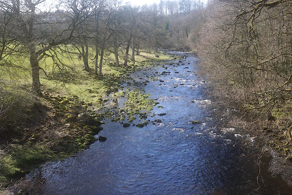 CFY55.jpg View of river. (taken 26.3.2017) |
||
|
|
||
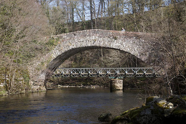 CFY52.jpg (taken 26.3.2017) |
||
|
|
||
 Lakes Guides menu.