 Old Cumbria Gazetteer
 |
 |
|
| Low Gregg Hall, Underbarrow and Bradleyfield | ||
| Low Gregghall Farm | ||
| Low Grigghall | ||
| locality:- | Grigghall | |
| civil parish:- | Underbarrow and Bradleyfield (formerly Westmorland) | |
| county:- | Cumbria | |
| locality type:- | buildings | |
| coordinates:- | SD46469147 | |
| 1Km square:- | SD4691 | |
| 10Km square:- | SD49 | |
| references:- | Listed Buildings 2010 |
|
|
|
||
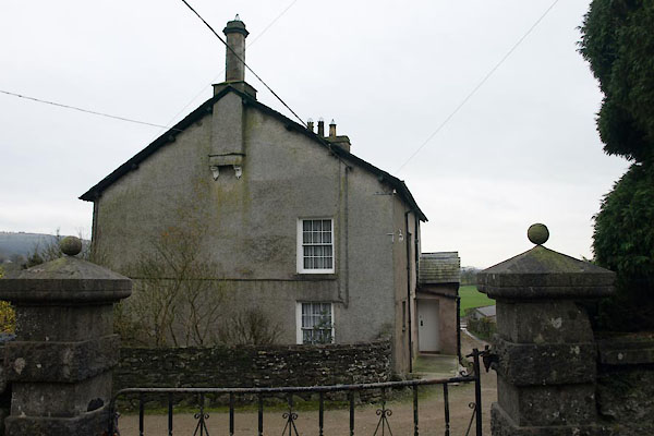 BWB82.jpg (taken 16.3.2012) 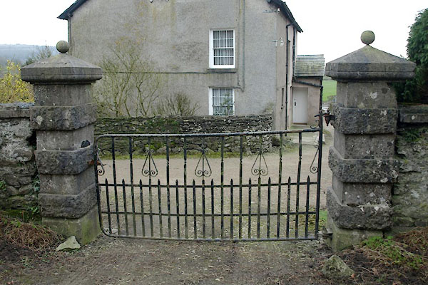 BWB83.jpg Gate. (taken 16.3.2012) |
||
|
|
||
| evidence:- | old map:- Ford 1839 map placename:- Grigg Hall |
|
| source data:- | Map, uncoloured engraving, Map of the Lake District of
Cumberland, Westmoreland and Lancashire, scale about 3.5 miles
to 1 inch, published by Charles Thurnam, Carlisle, and by R
Groombridge, 5 Paternoster Row, London, 3rd edn 1843.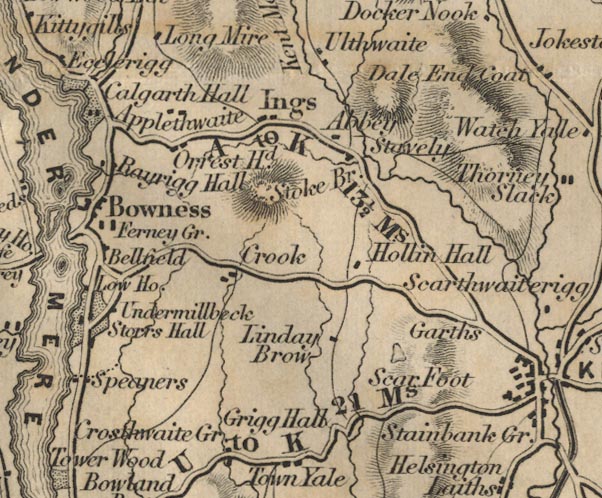 FD02SD49.jpg "Grigg Hall" item:- JandMN : 100.1 Image © see bottom of page |
|
|
|
||
| evidence:- | database:- Listed Buildings 2010 placename:- Low Gregghall Farm |
|
| source data:- | courtesy of English Heritage "LOW GREGGHALL FARMHOUSE / / / UNDERBARROW AND BRADLEYFIELD / SOUTH LAKELAND / CUMBRIA / II / 75309 / SD4646491473" |
|
|
|
||
| evidence:- | database:- Listed Buildings 2010 |
|
| source data:- | courtesy of English Heritage "BARN TO EAST OF LOW GREGGHALL FARMHOUSE / / / UNDERBARROW AND BRADLEYFIELD / SOUTH LAKELAND / CUMBRIA / II / 75311 / SD4648891478" |
|
|
|
||
| evidence:- | database:- Listed Buildings 2010 |
|
| source data:- | courtesy of English Heritage "BARN AND WALLS TO NORTH EAST OF LOW GREGGHALL FARMHOUSE / / / UNDERBARROW AND BRADLEYFIELD / SOUTH LAKELAND / CUMBRIA / II / 412991 / SD4647491498" |
|
|
|
||
| evidence:- | database:- Listed Buildings 2010 |
|
| source data:- | courtesy of English Heritage "WALLS, GATEPIERS AND GATE TO NORTH EAST OF LOW GREGGHALL FARMHOUSE / / / UNDERBARROW AND BRADLEYFIELD / SOUTH LAKELAND / CUMBRIA / II / 75310 / SD4646191484" |
|
|
|
||
 Lakes Guides menu.