 Old Cumbria Gazetteer
 |
 |
|
| Low Hundhowe, Strickland Roger | ||
| Low Hundhowe | ||
| Low Hundhowe Farm | ||
| civil parish:- | Strickland Roger (formerly Westmorland) | |
| county:- | Cumbria | |
| locality type:- | buildings | |
| coordinates:- | SD49489784 | |
| 1Km square:- | SD4997 | |
| 10Km square:- | SD49 | |
| references:- | Listed Buildings 2010 |
|
|
|
||
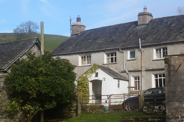 CFR81.jpg (taken 11.11.2016) 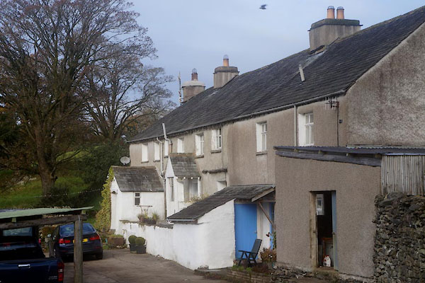 CFR80.jpg (taken 11.11.2016) |
||
|
|
||
| evidence:- | old map:- OS County Series (Wmd 33 11) placename:- Low Hundhowe placename:- Hundhowe, Low |
|
| source data:- | Maps, County Series maps of Great Britain, scales 6 and 25
inches to 1 mile, published by the Ordnance Survey, Southampton,
Hampshire, from about 1863 to 1948. |
|
|
|
||
| evidence:- | old map:- Jefferys 1770 (Wmd) placename:- Hund How |
|
| source data:- | Map, 4 sheets, The County of Westmoreland, scale 1 inch to 1
mile, surveyed 1768, and engraved and published by Thomas
Jefferys, London, 1770.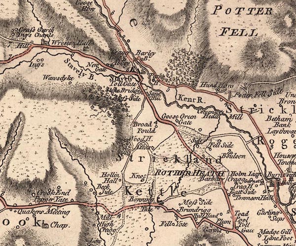 J5SD49NE.jpg "Hund How" circle, labelled in italic lowercase text; settlement, farm, house, or hamlet? item:- National Library of Scotland : EME.s.47 Image © National Library of Scotland |
|
|
|
||
| evidence:- | old map:- Cary 1789 (edn 1805) placename:- Hund Horn |
|
| source data:- | Map, uncoloured engraving, Westmoreland, scale about 2.5 miles
to 1 inch, by John Cary, London, 1789; edition 1805.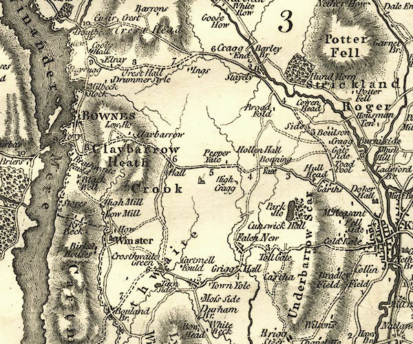 CY24SD49.jpg "Hund Horn" block/s, labelled in italic lowercase; house, or hamlet item:- JandMN : 129 Image © see bottom of page |
|
|
|
||
| evidence:- | database:- Listed Buildings 2010 placename:- Low Hundhowe |
|
| source data:- | courtesy of English Heritage "LOW HUNDHOWE AND ATTACHED OUTBUILDING / / / STRICKLAND ROGER / SOUTH LAKELAND / CUMBRIA / II / 76428 / SD4948497845" |
|
|
|
||
 Lakes Guides menu.