 Old Cumbria Gazetteer
 |
 |
|
| Moorleys Farm, St Bees | ||
| Moorleys Farm | ||
| civil parish:- | St Bees (formerly Cumberland) | |
| county:- | Cumbria | |
| locality type:- | buildings | |
| coordinates:- | NX98501054 | |
| 1Km square:- | NX9810 | |
| 10Km square:- | NX91 | |
| references:- | Listed Buildings 2010 |
|
|
|
||
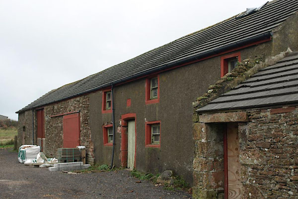 BXQ60.jpg (taken 16.11.2012) 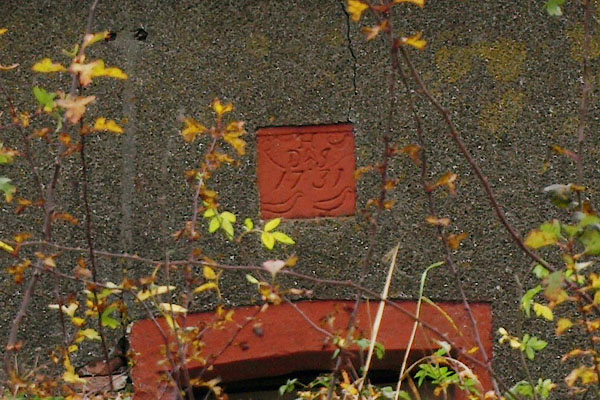 BXQ61.jpg Date stone:- "H / D J / 1731" (taken 16.11.2012) |
||
|
|
||
| evidence:- | old map:- OS County Series (Cmd 72 6) placename:- Moorleys |
|
| source data:- | Maps, County Series maps of Great Britain, scales 6 and 25
inches to 1 mile, published by the Ordnance Survey, Southampton,
Hampshire, from about 1863 to 1948. |
|
|
|
||
| evidence:- | old map:- Donald 1774 (Cmd) placename:- Mora Leys |
|
| source data:- | Map, hand coloured engraving, 3x2 sheets, The County of Cumberland, scale about 1
inch to 1 mile, by Thomas Donald, engraved and published by Joseph Hodskinson, 29
Arundel Street, Strand, London, 1774.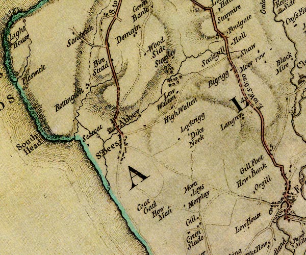 D4NX91SE.jpg "Mora Leys" block or blocks, labelled in lowercase; a hamlet or just a house item:- Carlisle Library : Map 2 Image © Carlisle Library |
|
|
|
||
| evidence:- | database:- Listed Buildings 2010 placename:- Moorleys Farm item:- date stone (1731) |
|
| source data:- | courtesy of English Heritage "MOORLEYS FARMHOUSE, COTTAGE, AND BARN TO NORTH EAST OF HOW MAN / / / ST BEES / COPELAND / CUMBRIA / II / 76152 / NX9850610543" |
|
|
|
||
 Lakes Guides menu.