 Old Cumbria Gazetteer
 |
 |
|
| Newland Bottom Mill, Egton with Newland | ||
| Newland Bottom Mill | ||
| Mill Farm | ||
| site name:- | Newland Beck | |
| locality:- | Newland Bottom | |
| civil parish:- | Egton with Newland (formerly Lancashire) | |
| county:- | Cumbria | |
| locality type:- | buildings | |
| locality type:- | water mill | |
| locality type:- | mill | |
| locality type:- | corn mill | |
| coordinates:- | SD29678012 | |
| 1Km square:- | SD2980 | |
| 10Km square:- | SD28 | |
| references:- | Listed Buildings 2010 |
|
|
|
||
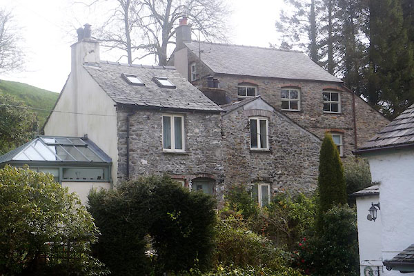 CEY24.jpg (taken 29.4.2016) |
||
| It is difficut to decide from the Listed Building descriptions, which is the listed
property. |
||
|
|
||
| evidence:- | old map:- OS County Series (Lan 11 16) placename:- Newland Bottom Mill |
|
| source data:- | Maps, County Series maps of Great Britain, scales 6 and 25
inches to 1 mile, published by the Ordnance Survey, Southampton,
Hampshire, from about 1863 to 1948. "Newland Bottom Mill (Corn)" |
|
|
|
||
| evidence:- | database:- Listed Buildings 2010 placename:- Newland Bottom Mill item:- date stone (1712) |
|
| source data:- | courtesy of English Heritage "NEWLAND BOTTOM MILL / / / EGTON WITH NEWLAND / SOUTH LAKELAND / CUMBRIA / II / 75859 / SD2966580117" |
|
|
|
||
| MN photo:- |
Other buildings on the site. |
|
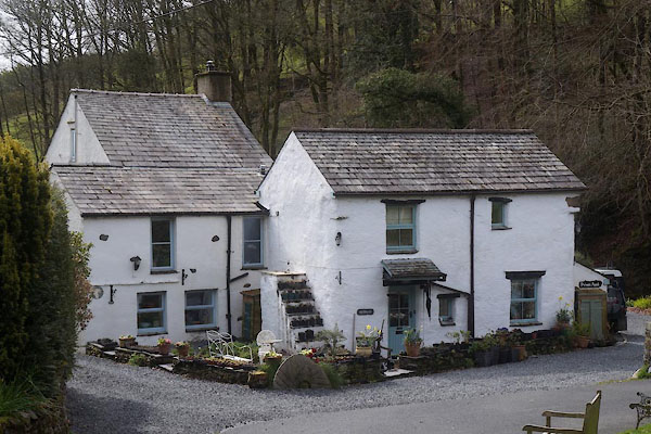 CEY23.jpg (taken 29.4.2016)  CEY25.jpg (taken 29.4.2016) |
||
|
|
||
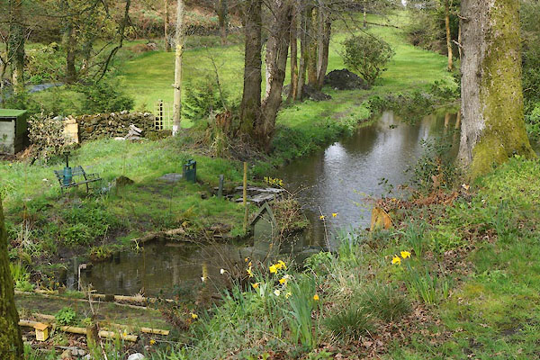 CEY26.jpg Mill pond. (taken 29.4.2016) |
||
|
|
||
 Lakes Guides menu.