 Old Cumbria Gazetteer
 |
 |
|
| North Bank, Eamont Bridge | ||
| North Bank | ||
| Street:- | Skirsgill Lane | |
| civil parish:- | Penrith (formerly Cumberland) | |
| county:- | Cumbria | |
| locality type:- | buildings | |
| coordinates:- | NY51922877 | |
| 1Km square:- | NY5128 | |
| 10Km square:- | NY52 | |
| references:- | Listed Buildings 2010 |
|
|
|
||
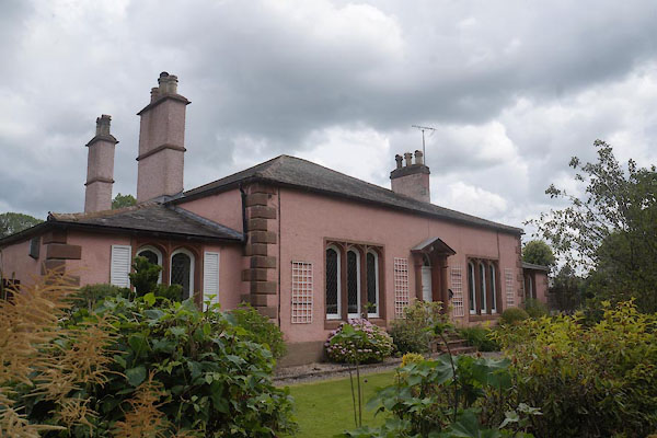 CBA08.jpg (taken 6.7.2014) 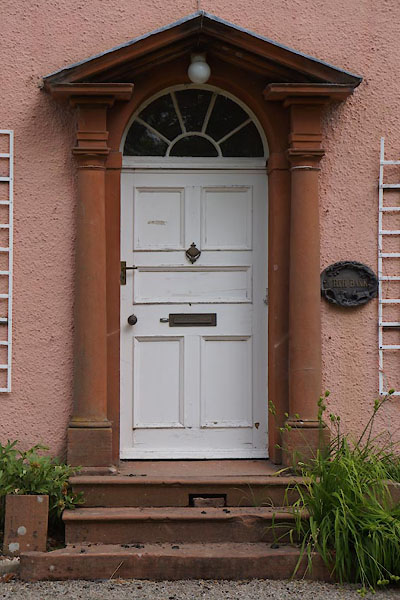 CBA09.jpg Door. (taken 6.7.2014) |
||
|
|
||
| evidence:- | old map:- OS County Series (Cmd 58 8) placename:- Eamont Cottage |
|
| source data:- | Maps, County Series maps of Great Britain, scales 6 and 25
inches to 1 mile, published by the Ordnance Survey, Southampton,
Hampshire, from about 1863 to 1948. |
|
|
|
||
| evidence:- | database:- Listed Buildings 2010 placename:- North Bank |
|
| source data:- | courtesy of English Heritage "NORTH BANK / / SKIRSGILL LANE / PENRITH / EDEN / CUMBRIA / II / 72943 / NY5191428768" |
|
|
|
||
 Lakes Guides menu.