 Old Cumbria Gazetteer
 |
 |
|
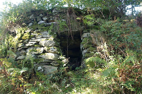
| potash kiln, Water Yeat Bridge | ||
| locality:- | Water Yeat Bridge | |
| civil parish:- | Broughton West (formerly Lancashire) | |
| county:- | Cumbria | |
| locality type:- | potash kiln | |
| coordinates:- | SD23809302 (approx) | |
| 1Km square:- | SD2393 | |
| 10Km square:- | SD29 | |
| stratigraphy:- | Coniston Limestone Series | |
|
|
||
 BTR01.jpg (taken 11.10.2010) 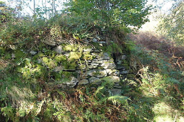 BTR02.jpg (taken 11.10.2010) |
||
|
|
||
| evidence:- | old map:- OS County Series (Lan 4 13) |
|
| source data:- | Maps, County Series maps of Great Britain, scales 6 and 25
inches to 1 mile, published by the Ordnance Survey, Southampton,
Hampshire, from about 1863 to 1948. "Old Limekiln" |
|
|
|
||
| evidence:- | database:- Listed Buildings 2010 |
|
| source data:- | courtesy of English Heritage "POTASH KILN TO WEST OF WATER YEAT BRIDGE / / / DUNNERDALE WITH SEATHWAITE / SOUTH LAKELAND / CUMBRIA / II / 75845 / SD2381793014" |
|
| source data:- | courtesy of English Heritage "Potash kiln. Probably C18. Stone rubble. Shallow round structure on sloping ground with rectangular fire hole, the soffit of which slopes down. shallow bowl within. A rare example of a type of kiln which went out of use c1800." |
|
|
|
||
 Lakes Guides menu.