 Old Cumbria Gazetteer
 |
 |
|
| Rigghead, Hethersgill | ||
| Rigghead | ||
| civil parish:- | Hethersgill (formerly Cumberland) | |
| county:- | Cumbria | |
| locality type:- | buildings | |
| coordinates:- | NY44446685 | |
| 1Km square:- | NY4466 | |
| 10Km square:- | NY46 | |
| references:- | Listed Buildings 2010 |
|
|
|
||
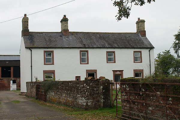 BZJ59.jpg (taken 27.9.2013) 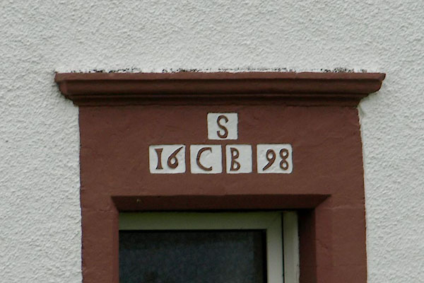 BZJ60.jpg Date stone:- "S / 16 C B 98" (taken 27.9.2013) |
||
|
|
||
| evidence:- | old map:- OS County Series (Cmd 11 9) placename:- Rigghead |
|
| source data:- | Maps, County Series maps of Great Britain, scales 6 and 25
inches to 1 mile, published by the Ordnance Survey, Southampton,
Hampshire, from about 1863 to 1948. |
|
|
|
||
| evidence:- | database:- Listed Buildings 2010 placename:- Rigghead item:- date stone (1698) |
|
| source data:- | courtesy of English Heritage "RIGGHEAD / / / HETHERSGILL / CARLISLE / CUMBRIA / II / 77887 / NY4444366857" |
|
|
|
||
 Lakes Guides menu.