Old Cumbria Gazetteer
 |
 |
|
||
| included in:- |
 road, Carlisle to Edinburgh road, Carlisle to Edinburgh |
|||
| road, Longtown to Edinburgh | ||||
| Longtown to Edinburgh | ||||
| Edinburgh to Longtown | ||||
| A7 | ||||
| civil parish:- | Arthuret (formerly Cumberland) | |||
| civil parish:- | Kirkandrews (formerly Cumberland) | |||
| county:- | Cumbria | |||
| locality type:- | road route | |||
| 10Km square:- | NY36 | |||
| 10Km square:- | NY46 | |||
| country:- | Scotland | |||
| locality type:- | road | |||
| locality type:- | route | |||
| 10Km square:- | NY37 | |||
| 10Km square:- | NY38 | |||
|
|
||||
| evidence:- | old map:- Badeslade 1742 placename:- |
|||
| source data:- | Map, uncoloured engraving, A Map of Cumberland North from
London, scale about 11 miles to 1 inch, with descriptive text,
by Thomas Badeslade, London, engraved and published by William
Henry Toms, Union Court, Holborn, London, 1742. click to enlarge click to enlargeBD10.jpg "" item:- JandMN : 115 Image © see bottom of page |
|||
|
|
||||
| evidence:- | old map:- Donald 1774 (Cmd) |
|||
| source data:- | Map, hand coloured engraving, 3x2 sheets, The County of Cumberland, scale about 1
inch to 1 mile, by Thomas Donald, engraved and published by Joseph Hodskinson, 29
Arundel Street, Strand, London, 1774. double line, solid or dotted, with a dot or milestone and number at 1 mile intervals, tinted red; turnpike road 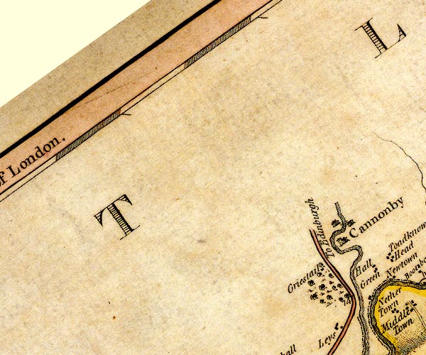 D4NY37NE.jpg "To Edinburgh" 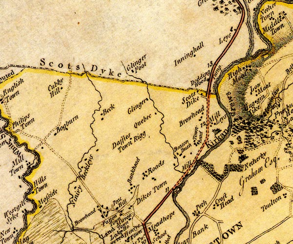 D4NY37SE.jpg into Scotland at Scots Dike 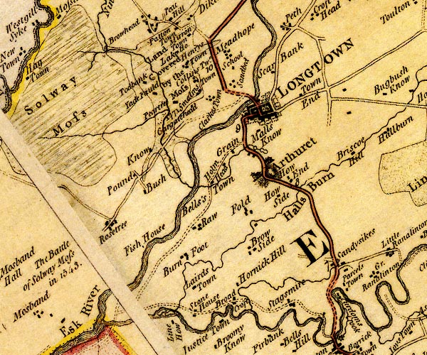 D4NY36NE.jpg item:- Carlisle Library : Map 2 Images © Carlisle Library |
|||
|
|
||||
| evidence:- | road map:- Cary 1790 (Cmd/edn 1789) |
|||
| source data:- | Road map, hand coloured engraving, Cumberland, scale about 15
miles to 1 inch, by John Cary, 181 Strand, London, 1790, edn
1789.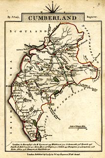 click to enlarge click to enlargeCY47.jpg "the Edinburgh Road" double line item:- JandMN : 419 Image © see bottom of page |
|||
|
|
||||
| evidence:- | road book:- Cary 1798 (2nd edn 1802) |
|||
| source data:- | Road book, itineraries, Cary's New Itinerary, by John Cary, 181
Strand, London, 2nd edn 1802. goto source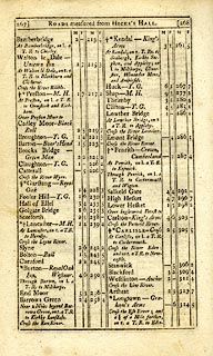 click to enlarge click to enlargeC38267.jpg page 267-268 "Cross the Esk River; and 1¼of a Mile further, on r. a T.R. to Edin[burgh, through Longholm." goto source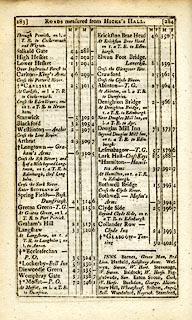 click to enlarge click to enlargeC38283.jpg page 283-284 "Cross the Esk River; and a ¼of a Mile beyond Longtown, on r. a T.R. to Edinburgh, thro' Longholm" goto source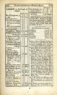 click to enlarge click to enlargeC38337.jpg page 337-338 "LONDON to Edinburgh, by Selkirk." part of item:- JandMN : 228.1 Image © see bottom of page |
|||
|
|
||||
| evidence:- | old map:- Cooke 1802 |
|||
| source data:- | Map, Cumberland, scale about 15.5 miles to 1 inch, by George
Cooke, 1802, bound in Gray's New Book of Roads, 1824, published
by Sherwood, Jones and Co, Paternoster Road, London, 1824. click to enlarge click to enlargeGRA1Cd.jpg "the Edinburgh Road" double line, light dark solid; road item:- Hampshire Museums : FA2000.62.2 Image © see bottom of page |
|||
|
|
||||
| evidence:- | old map:- Wallis 1810 (Cmd) |
|||
| source data:- | Road map, hand coloured engraving, Cumberland, scale about 16
miles to 1 inch, by James Wallis, 77 Berwick Stree, Soho,
London, 1810. click to enlarge click to enlargeWL13.jpg "to Edinburgh" double line, hatched; 'Mail Coach Road' item:- Dove Cottage : 2009.81.10 Image © see bottom of page |
|||
|
|
||||
| evidence:- | old text:- Gents Mag item:- Hints for a Tour in Scotland |
|||
| source data:- | Magazine, The Gentleman's Magazine or Monthly Intelligencer or
Historical Chronicle, published by Edward Cave under the
pseudonym Sylvanus Urban, and by other publishers, London,
monthly from 1731 to 1922. goto source Gentleman's Magazine 1812 part 2 p.6 "Hints for a Tour in SCOTLAND; in an Original Letter from the Hon. DAINES BARRINGTON to a Friend (probably Mr. PENNANT.)" "July 17, 1771." "DEAR SIR," "..." "From Carlisle there is a new turnpike quite to Edinburgh, with regular stages, and very decent accomodations." "I don't recollect any thing worth mentioning on this road, except that when you come to Selkirk you should inquire for Melrose Abbey.- I would advise you to lye there, as the house is a very decent one. It is not above 5 or 6 miles out of the road to Edinburgh." "... ..." |
|||
|
|
||||
| evidence:- | old map:- Hall 1820 (Cmd) |
|||
| source data:- | Map, hand coloured engraving, Cumberland, scale about 21 miles
to 1 inch, engraved by Sidney Hall, published by S Leigh, 18
Strand, London, 1820-31. click to enlarge click to enlargeHA14.jpg "To Langholm" double line, solid; main road; Longtown, Kirkandrews, ... item:- JandMN : 91 Image © see bottom of page |
|||
|
|
||||
| evidence:- | old strip map:- Smith 1826 (Roads/Cum) |
|||
| source data:- | Strip map, pp.103-105, including To Glasgow by Carlisle, Moffat and Hamilton, published
by Charles Smith and Son, 172 Strand, London, 1st edn 1826.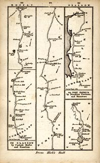 click to enlarge click to enlargeSM22M7.jpg From Longtown, Cumberland; into Scotland; and other routes. Included in Smith's Pocket New Companion to the Roads of England and Wales. printed at p.103:- "TO GLASGOW / by Carlisle Moffat / and Hamilton" item:- private collection : 269.7 Image © see bottom of page |
|||
|
|
||||
| evidence:- | old map:- Bell 1892 |
|||
| source data:- | Map, colour lithograph, Road Map of Cumberland, by George Joseph
Bell, scale about 2.5 miles to 1 inch, printed by Charles
Thurnam and Sons, Carlisle, Cumberland, 1892.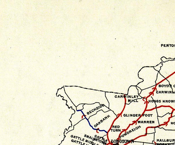 BEL9NY37.jpg  BEL9NY36.jpg red - disturnpiked 'main road' under section 13 of the Highways Act 1878 Road map of Cumberland showing County Bridges item:- Carlisle Library : Map 38 Images © Carlisle Library |
|||
|
|
||||
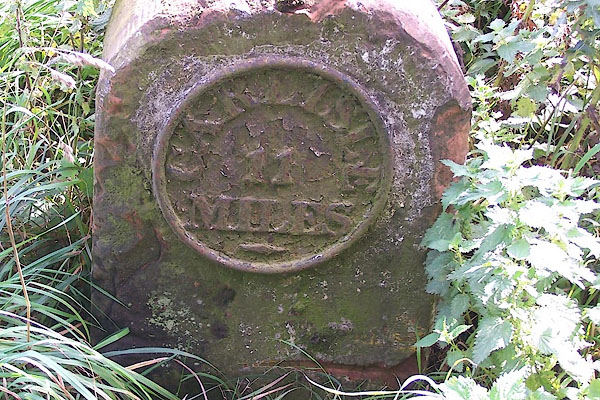
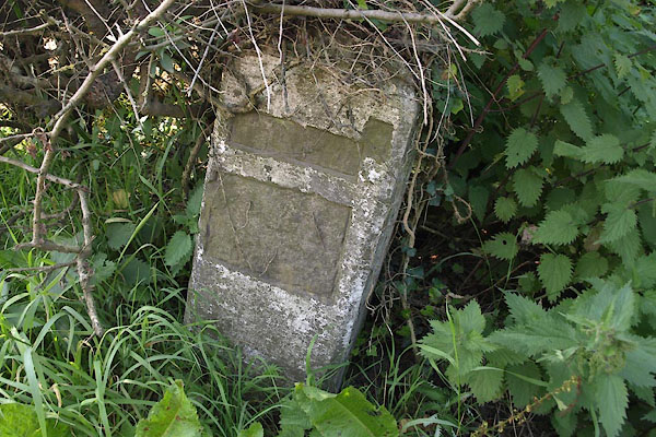
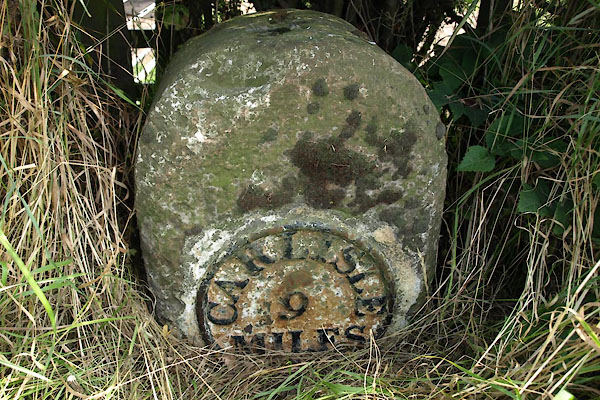
| places:- | Longtown Scotsdike, Kirkandrews Canonbie, Scotland Langholm, Scotland Edinburgh, Scotland |
|||
|
|
||||
| places:- |
|
|||
|
||||
|
||||
|
||||
Lakes Guides menu.