 Old Cumbria Gazetteer
 |
 |
|
| Roger Ground House, Roger Ground | ||
| Roger Ground House | ||
| locality:- | Roger Ground | |
| civil parish:- | Hawkshead (formerly Lancashire) | |
| county:- | Cumbria | |
| locality type:- | buildings | |
| coordinates:- | SD35119756 | |
| 1Km square:- | SD3597 | |
| 10Km square:- | SD39 | |
| references:- | Listed Buildings 2010 |
|
|
|
||
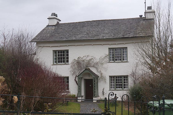 CES52.jpg (taken 11.3.2016) 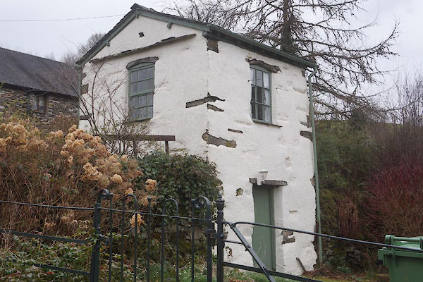 CES53.jpg Summer house? (taken 11.3.2016) |
||
|
|
||
| evidence:- | old map:- Jefferys 1770 (Wmd) placename:- Roger Grownd |
|
| source data:- | Map, 4 sheets, The County of Westmoreland, scale 1 inch to 1
mile, surveyed 1768, and engraved and published by Thomas
Jefferys, London, 1770.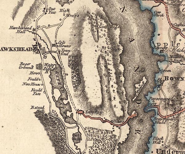 J5SD39NE.jpg "Roger Grownd" circle, labelled in italic lowercase text; settlement, farm, house, or hamlet? item:- National Library of Scotland : EME.s.47 Image © National Library of Scotland |
|
|
|
||
| evidence:- | old map:- Cary 1789 (edn 1805) placename:- Roger Ground |
|
| source data:- | Map, uncoloured engraving, Westmoreland, scale about 2.5 miles
to 1 inch, by John Cary, London, 1789; edition 1805.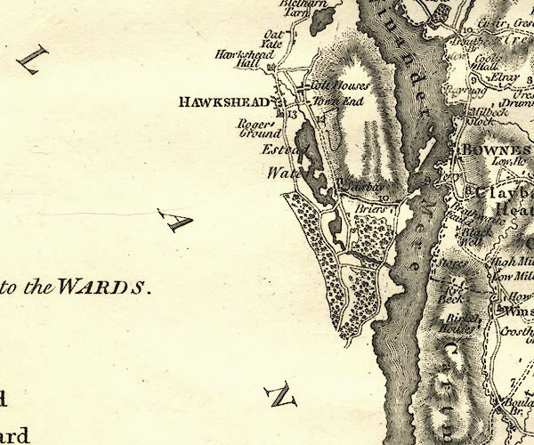 CY24SD39.jpg "Roger Ground" block/s, labelled in italic lowercase; house, or hamlet item:- JandMN : 129 Image © see bottom of page |
|
|
|
||
| evidence:- | database:- Listed Buildings 2010 placename:- Roger Ground House |
|
| source data:- | courtesy of English Heritage "ROGER GROUND HOUSE / / / HAWKSHEAD / SOUTH LAKELAND / CUMBRIA / II / 76858 / SD3511097569" |
|
|
|
||
 Lakes Guides menu.