 Old Cumbria Gazetteer
 |
 |
|
| Thorpe Farm, Greystoke | ||
| Thorpe Farm | ||
| Thorpe | ||
| locality:- | Greystoke | |
| civil parish:- | Greystoke (formerly Cumberland) | |
| county:- | Cumbria | |
| locality type:- | buildings | |
| coordinates:- | NY44223108 | |
| 1Km square:- | NY4431 | |
| 10Km square:- | NY43 | |
| references:- | Listed Buildings 2010 |
|
|
|
||
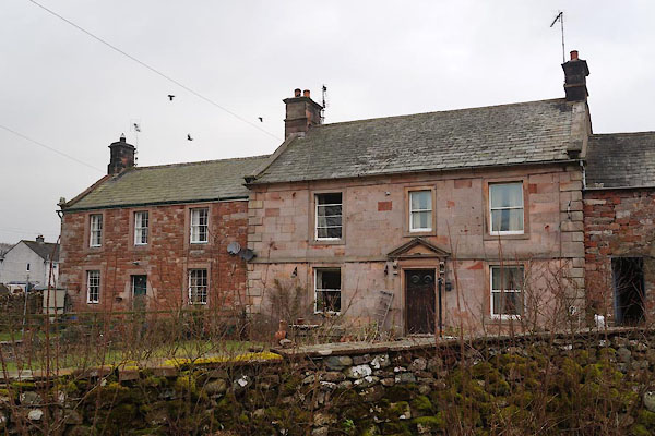 CCK18.jpg (taken 13.2.2015) |
||
|
|
||
| evidence:- | old map:- OS County Series (Cmd 58 1) placename:- Thorpe |
|
| source data:- | Maps, County Series maps of Great Britain, scales 6 and 25
inches to 1 mile, published by the Ordnance Survey, Southampton,
Hampshire, from about 1863 to 1948. |
|
|
|
||
| evidence:- | database:- Listed Buildings 2010 placename:- Thorpe Farm |
|
| source data:- | courtesy of English Heritage "THORPE FARMHOUSE / / / GREYSTOKE / EDEN / CUMBRIA / II / 73827 / NY4422831080" |
|
|
|
||
 Lakes Guides menu.