 Old Cumbria Gazetteer
 |
 |
|
| Tithe Barn Farm, Warwick-on-Eden | ||
| Tithe Barn Farm | ||
| locality:- | Warwick-on-Eden | |
| civil parish:- | Wetheral (formerly Cumberland) | |
| county:- | Cumbria | |
| locality type:- | buildings | |
| coordinates:- | NY46505661 | |
| 1Km square:- | NY4656 | |
| 10Km square:- | NY45 | |
| references:- | Listed Buildings 2010 |
|
|
|
||
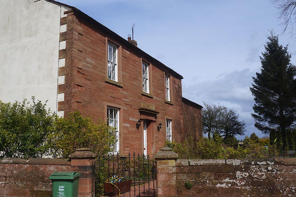 CEV02.jpg (taken 8.4.2016) 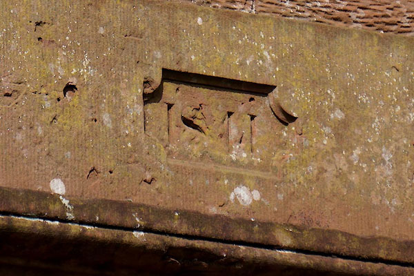 CEV03.jpg Date stone:- "1841" (taken 8.4.2016) |
||
|
|
||
| evidence:- | probably old map:- OS County Series (Cmd 24 2) placename:- Tithebarn Hill |
|
| source data:- | Maps, County Series maps of Great Britain, scales 6 and 25
inches to 1 mile, published by the Ordnance Survey, Southampton,
Hampshire, from about 1863 to 1948. |
|
|
|
||
| evidence:- | database:- Listed Buildings 2010 placename:- Tithe Barn Farm |
|
| source data:- | courtesy of English Heritage "TITHE BARN FARMHOUSE / / A69 / WETHERAL / CARLISLE / CUMBRIA / II / 77740 / NY4650456615" |
|
|
|
||
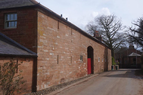 CEV04.jpg barn (taken 8.4.2016) 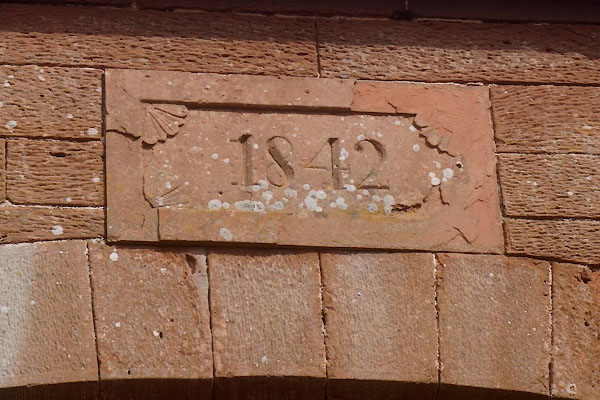 CEV05.jpg Date stone:- "1843" (taken 8.4.2016) |
||
|
|
||
 Lakes Guides menu.