 Old Cumbria Gazetteer
 |
 |
|
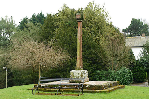
| Wetheral Cross, Wetheral | ||
| Wetheral Cross | ||
| Street:- | Green (The) | |
| locality:- | Wetheral | |
| civil parish:- | Wetheral (formerly Cumberland) | |
| county:- | Cumbria | |
| locality type:- | cross | |
| locality type:- | maypole (ex) | |
| coordinates:- | NY46655437 | |
| 1Km square:- | NY4654 | |
| 10Km square:- | NY45 | |
| references:- | Listed Buildings 2010 |
|
|
|
||
 BQF64.jpg (taken 11.3.2009) 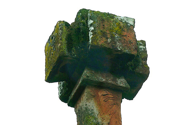 BQF65.jpg (taken 11.3.2009) |
||
|
|
||
| evidence:- | old map:- OS County Series (Cmd 24 6) placename:- Wetheral Abbey |
|
| source data:- | Maps, County Series maps of Great Britain, scales 6 and 25
inches to 1 mile, published by the Ordnance Survey, Southampton,
Hampshire, from about 1863 to 1948. |
|
|
|
||
| evidence:- | database:- Listed Buildings 2010 placename:- Wetheral Cross |
|
| source data:- | courtesy of English Heritage "WETHERAL CROSS / / THE GREEN / WETHERAL / CARLISLE / CUMBRIA / II / 77689 / NY4665754370" |
|
| source data:- | courtesy of English Heritage "Cross formerly maypole. Circa 1844 on steps of 1814 for Henry Howard. Red sandstone 3 1/2 metres high. 2 squared step slabs support chamfered plinth hollowed to form shaft socket: squared column with chamfered corners and head carved to give a quatra-form cross. Formerly the steps were in the centre of The Green and formed the base for a wooden maypole, which was erected at the expense of Henry Howard, of nearby Corby Castle, in 1814. Later replaced by stone cross, when moved to its present location. This is not a market cross as Wetheral was not a market town." |
|
|
|
||
 Lakes Guides menu.