 Old Cumbria Gazetteer
 |
 |
|
| Wreay Hall Mill, Hesket | ||
| Wreay Hall Mill | ||
| site name:- | Petteril, River | |
| civil parish:- | Hesket (formerly Cumberland) | |
| county:- | Cumbria | |
| locality type:- | water mill | |
| locality type:- | mill | |
| locality type:- | corn mill | |
| coordinates:- | NY44194911 | |
| 1Km square:- | NY4449 | |
| 10Km square:- | NY44 | |
| references:- | Listed Buildings 2010 |
|
|
|
||
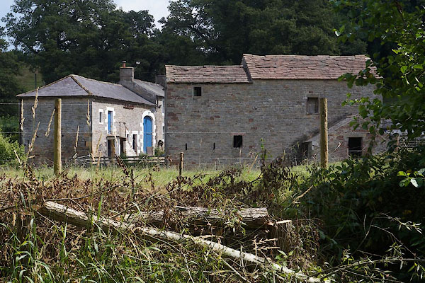 CBG02.jpg (taken 25.7.2014) 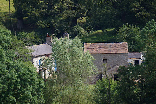 CBG03.jpg (taken 25.7.2014) |
||
|
|
||
| evidence:- | old map:- OS County Series (Cmd 31 5) placename:- Wreay Mill |
|
| source data:- | Maps, County Series maps of Great Britain, scales 6 and 25
inches to 1 mile, published by the Ordnance Survey, Southampton,
Hampshire, from about 1863 to 1948. "Wreay Mill (Corn) / Weir / Sluice / Mill Race / ..." |
|
|
|
||
| evidence:- | old map:- Donald 1774 (Cmd) |
|
| source data:- | Map, hand coloured engraving, 3x2 sheets, The County of Cumberland, scale about 1
inch to 1 mile, by Thomas Donald, engraved and published by Joseph Hodskinson, 29
Arundel Street, Strand, London, 1774.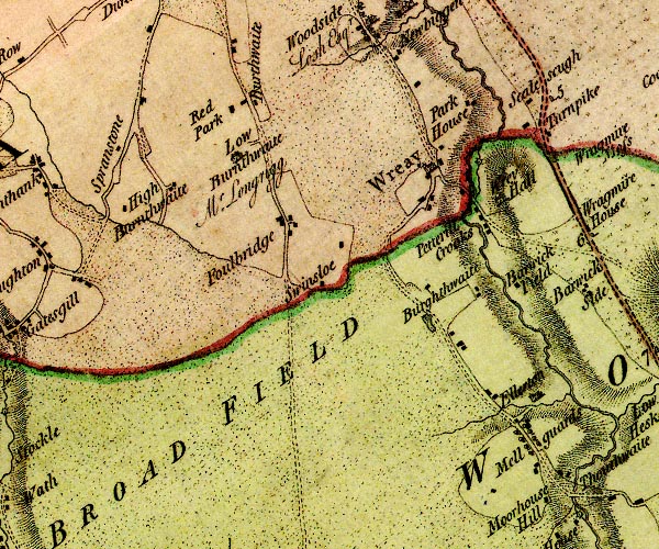 D4NY44NW.jpg circle with rays, mill wheel; a water mill E of Wreay item:- Carlisle Library : Map 2 Image © Carlisle Library |
|
|
|
||
| evidence:- | database:- Listed Buildings 2010 placename:- Wreay Hall Mill |
|
| source data:- | courtesy of English Heritage "WREAY HALL MILL / / / HESKET / EDEN / CUMBRIA / II / 492471 / NY4419449111" |
|
|
|
||
 Lakes Guides menu.