 Old Cumbria Gazetteer
 |
 |
|
| Abbey Town: Ferguson Fuels | ||
| Ferguson Fuels coal yard | ||
| locality:- | Abbey Town | |
| civil parish:- | Holme Abbey (formerly Cumberland) | |
| county:- | Cumbria | |
| locality type:- | coal depot | |
| locality type:- | workplace | |
| coordinates:- | NY17365087 | |
| 1Km square:- | NY1750 | |
| 10Km square:- | NY15 | |
|
|
||
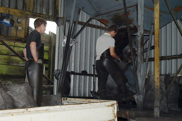
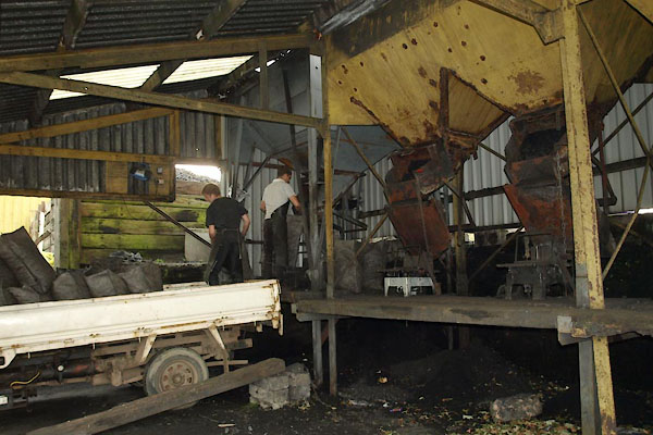 BVI57.jpg Filling sacks, loading the lorry. (taken 16.9.2011)  BVI59.jpg Filling sacks; the hopper outlet is operated by a treadle; notice the apron. (taken 16.9.2011) |
||
| The main coal stock piles are behind the loading shed, the hoppers filler from the
back. The loading bay is arranged to make best use of gravity. |
||
|
|
||
| evidence:- | old map:- OS County Series (Cmd 28) |
|
| source data:- | Maps, County Series maps of Great Britain, scales 6 and 25
inches to 1 mile, published by the Ordnance Survey, Southampton,
Hampshire, from about 1863 to 1948. "Railway Station / Coal &Lime Depot" |
|
|
|
||
 BVI58.jpg Filling sacks, loading the lorry. (taken 16.9.2011) 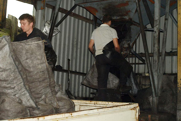 BVI60.jpg Filling sacks, loading the lorry. (taken 16.9.2011) 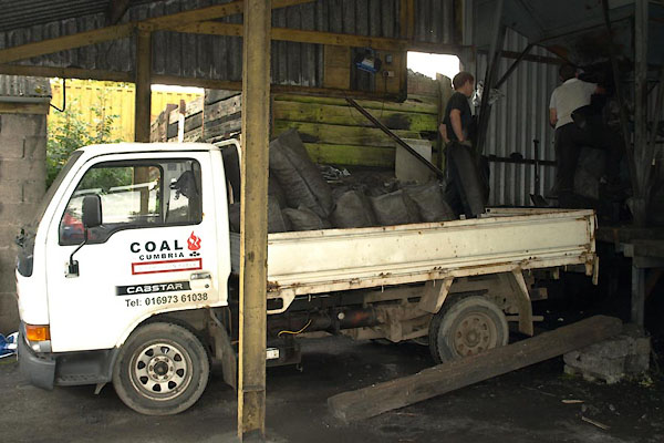 BVI56.jpg Lorry. (taken 16.9.2011) 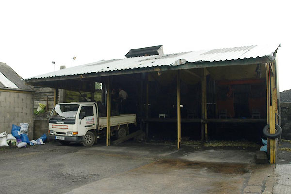 BVI55.jpg (taken 16.9.2011) 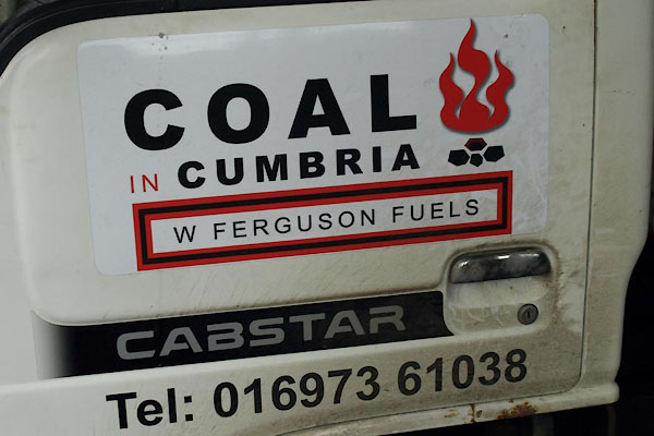 BVI61.jpg Lorry door:- "COAL IN / CUMBRIA / W FERGUSON FUELS ..." (taken 16.9.2011) 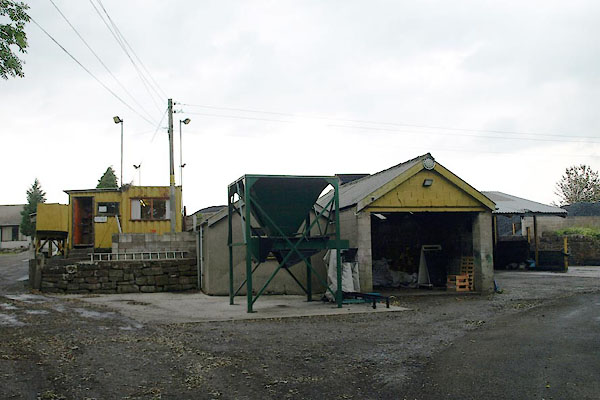 BVI62.jpg (taken 16.9.2011) 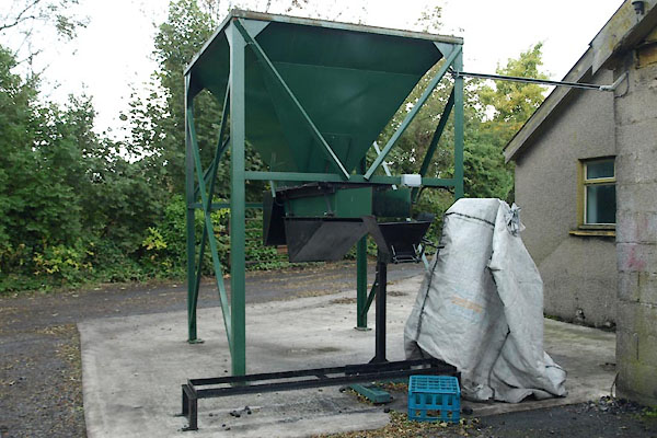 BVI63.jpg Hopper. (taken 16.9.2011) 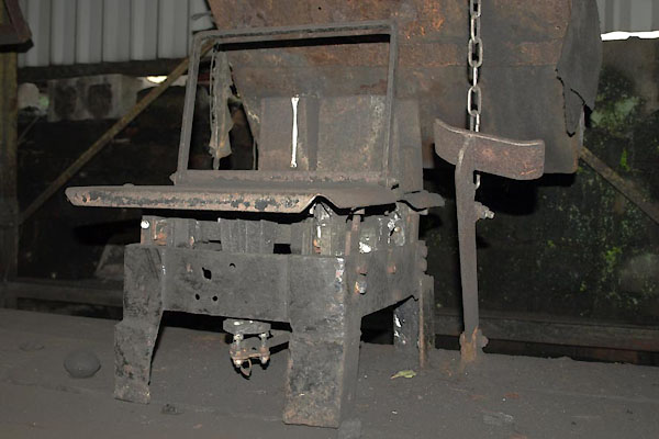 BVI64.jpg Scales; and notivce the treadle to work the hopper. (taken 16.9.2011) 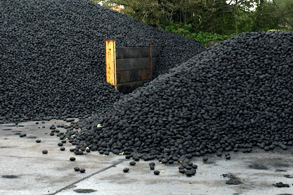 BVI65.jpg Coal. (taken 16.9.2011) 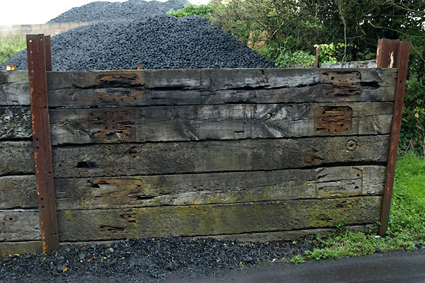 BVI66.jpg Fence, railway sleepers. (taken 16.9.2011) |
||
|
|
||
 Lakes Guides menu.